logo

The Rate of Evaporation and Flood in Windorah


Added on  2023-03-29

11 Pages1323 Words124 Views
Materials Science and Engineering
 | 
 | 
 | 
CONSTRUCTION MANAGEMENT
By Name
Course
Instructor
Institution
Location
Date
The Rate of Evaporation and Flood in Windorah_1

The rate of evaporation
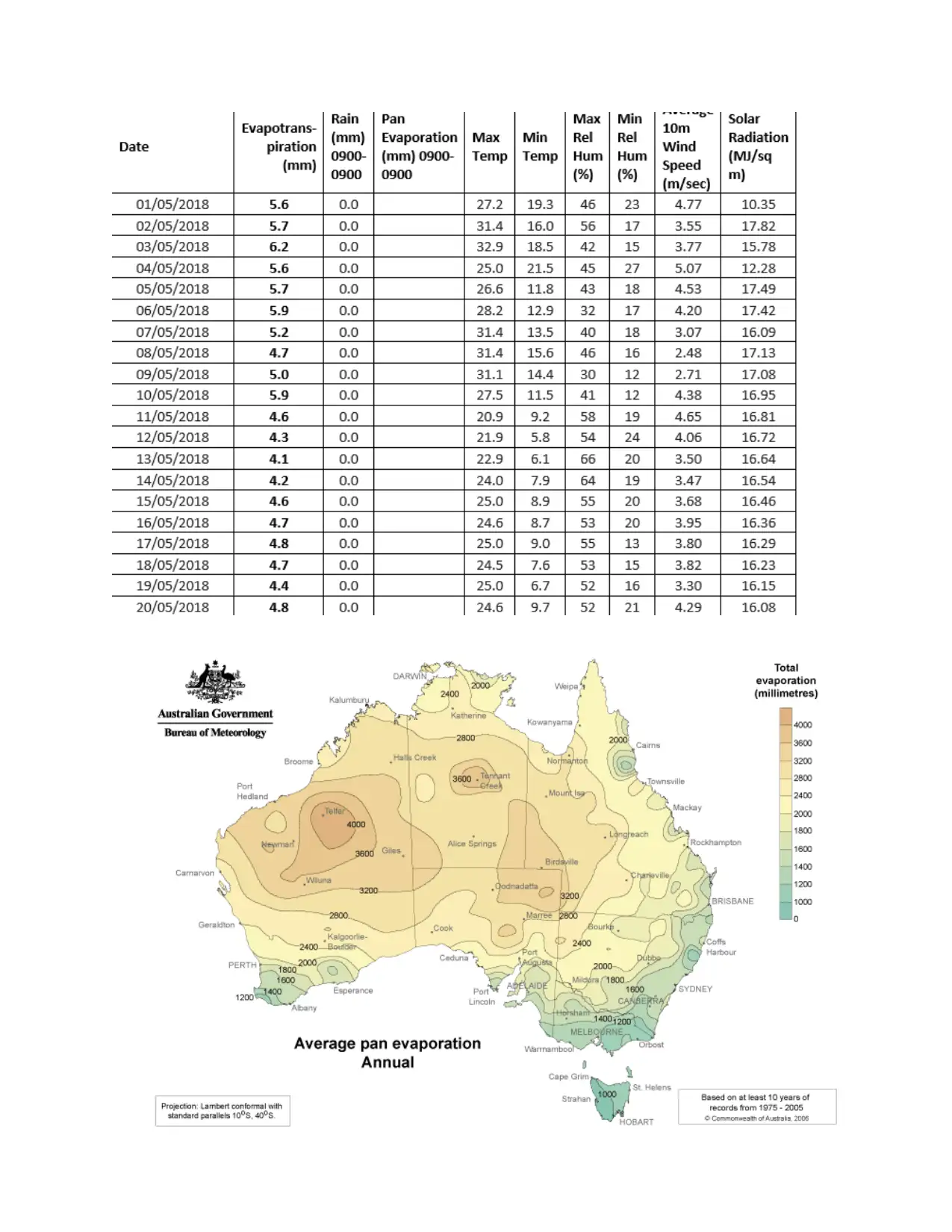
According to Australian Meteorology Bureau calculation of the annual average rate of pan
evaporation at wind rah QLD yearly at 3200mm. the figure is highly based on factor range that is
the temperature of the air, speed of wind, humility, as well as the cove of the clouds. This found
to give a higher record when the conditions are windy, hot and even dry though give lowest
record when the condition are both wet and cold(Davidson 2011).
The annual mean of pan evaporation was higher than 3000mm in the Queensland throughout
therefore making the Windorah to exceed its evaporation rate. When the evaporation rate goes
higher the soil moisture is also tending to get reduced thus affecting the development of crops as
well as the growth of pasture. This happen during very hot and dry periods during when the palm
has a high demand for water especially when there is low supply of water (Makani, Khorram and
Ahmadipur 2012)
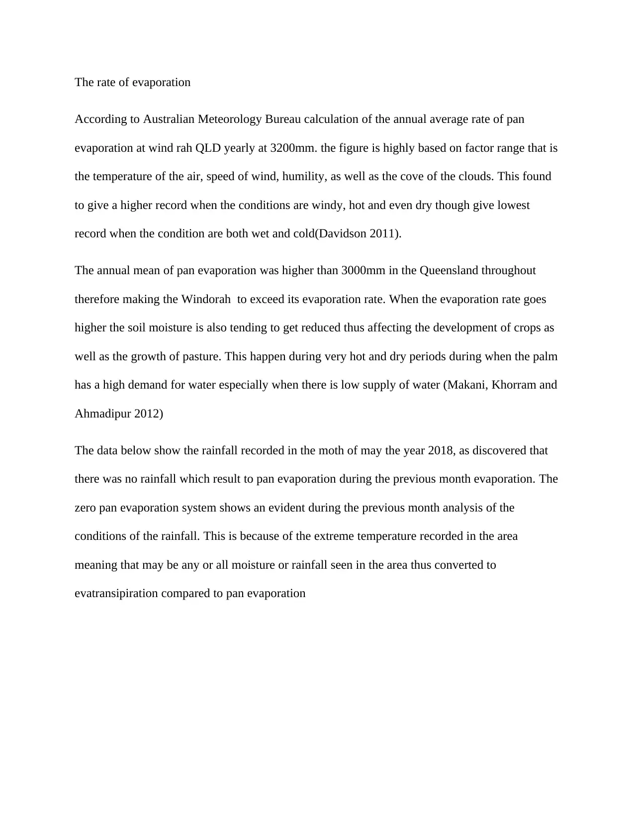
The data below show the rainfall recorded in the moth of may the year 2018, as discovered that
there was no rainfall which result to pan evaporation during the previous month evaporation. The
zero pan evaporation system shows an evident during the previous month analysis of the
conditions of the rainfall. This is because of the extreme temperature recorded in the area
meaning that may be any or all moisture or rainfall seen in the area thus converted to
evatransipiration compared to pan evaporation
The Rate of Evaporation and Flood in Windorah_2

The Rate of Evaporation and Flood in Windorah_3

The flood
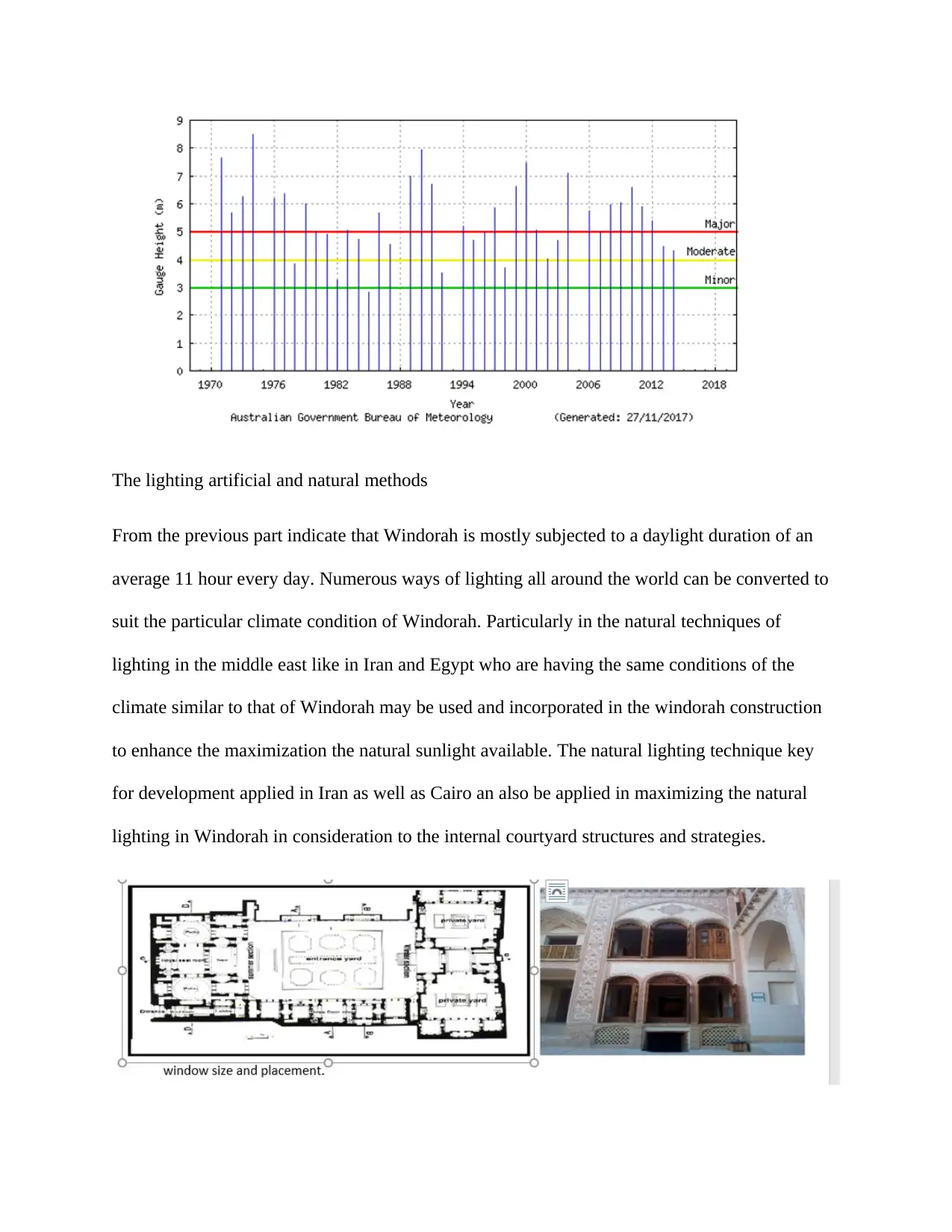
In the past ten decades windorah has been experiencing around forty flash event of
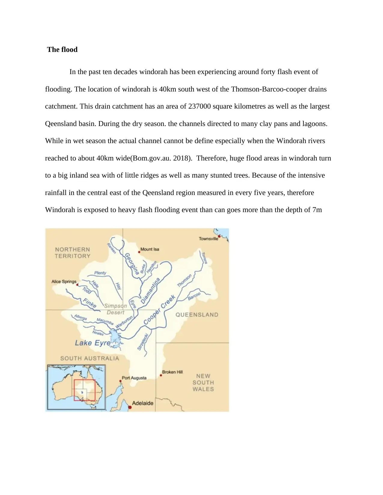
flooding. The location of windorah is 40km south west of the Thomson-Barcoo-cooper drains
catchment. This drain catchment has an area of 237000 square kilometres as well as the largest
Qeensland basin. During the dry season. the channels directed to many clay pans and lagoons.
While in wet season the actual channel cannot be define especially when the Windorah rivers
reached to about 40km wide(Bom.gov.au. 2018). Therefore, huge flood areas in windorah turn
to a big inland sea with of little ridges as well as many stunted trees. Because of the intensive
rainfall in the central east of the Qeensland region measured in every five years, therefore
Windorah is exposed to heavy flash flooding event than can goes more than the depth of 7m
The Rate of Evaporation and Flood in Windorah_4

End of preview

Want to access all the pages? Upload your documents or become a member.

Related Documents
Surface Water Hydrology
|5
|1078
|423

Surface Water Hydrology
|5
|1078
|111

A Research Report Regarding 2018 NSW Drought
|10
|2370
|59

Climate Scientists Warn of a 'Global Wildfire Crisis'
|7
|1328
|17