Comprehensive Land Capability Assessment at Ridgefield Farm, WA
VerifiedAdded on 2023/06/11
|45
|10821
|63
Report
AI Summary
This report provides a land capability assessment of Ridgefield Farm, focusing on soil characteristics and agricultural sustainability. The study reviews existing data and analyzes five profile samples, highlighting variations in acidity and erosion levels across the landscape. It addresses the challenges posed by Australia's weathered, shallow, and infertile soils, including issues like salinity, acidification, and low organic matter content. The report emphasizes the importance of soil management for maintaining agricultural productivity and reducing environmental impacts. It also explores the role of land capability mapping and remote sensing techniques in assessing land cover and identifying areas for improvement, considering factors like climate change and the need for sustainable land use practices. Desklib offers a wide range of similar solved assignments and past papers to aid students in their studies.
Land Capability Assessment
Name
Institution
Name
Institution
Paraphrase This Document
Need a fresh take? Get an instant paraphrase of this document with our AI Paraphraser
Land Capability Assessment
EXECUTIVE SUMMARY
With the ever increasing urge of promoting agricultural sector across the globe, there is an apparent
need to boast those factors that will see the stability in food production. One of the major impacts
that surround food productivity is the availability of a quality soil in a particular place. Apparently,
this means that the aspect of land capability remains an important practice in the haste to improve
the productivity of agriculture particularly in the vast Australian community.
Apparently, the study did not involve new soil study in the Ridgefield farm. Nonetheless, the study
involved the review process as well as updating the already existing work that was done in the area.
In essence, the usage of the already existing work was because it was highly relevant particularly
for the planning of the Ridgefield farm.
The study area involved five profile samples that were each performed in form of five groups that is
group 7, 8, 9, 10, and 11. The samples representing the landscape were found to have different
characteristics ranging from acidity levels to the level of erosion. Land assessment procedure was
done to be enabling to analyses capability of the soil to withstand different agricultural use.
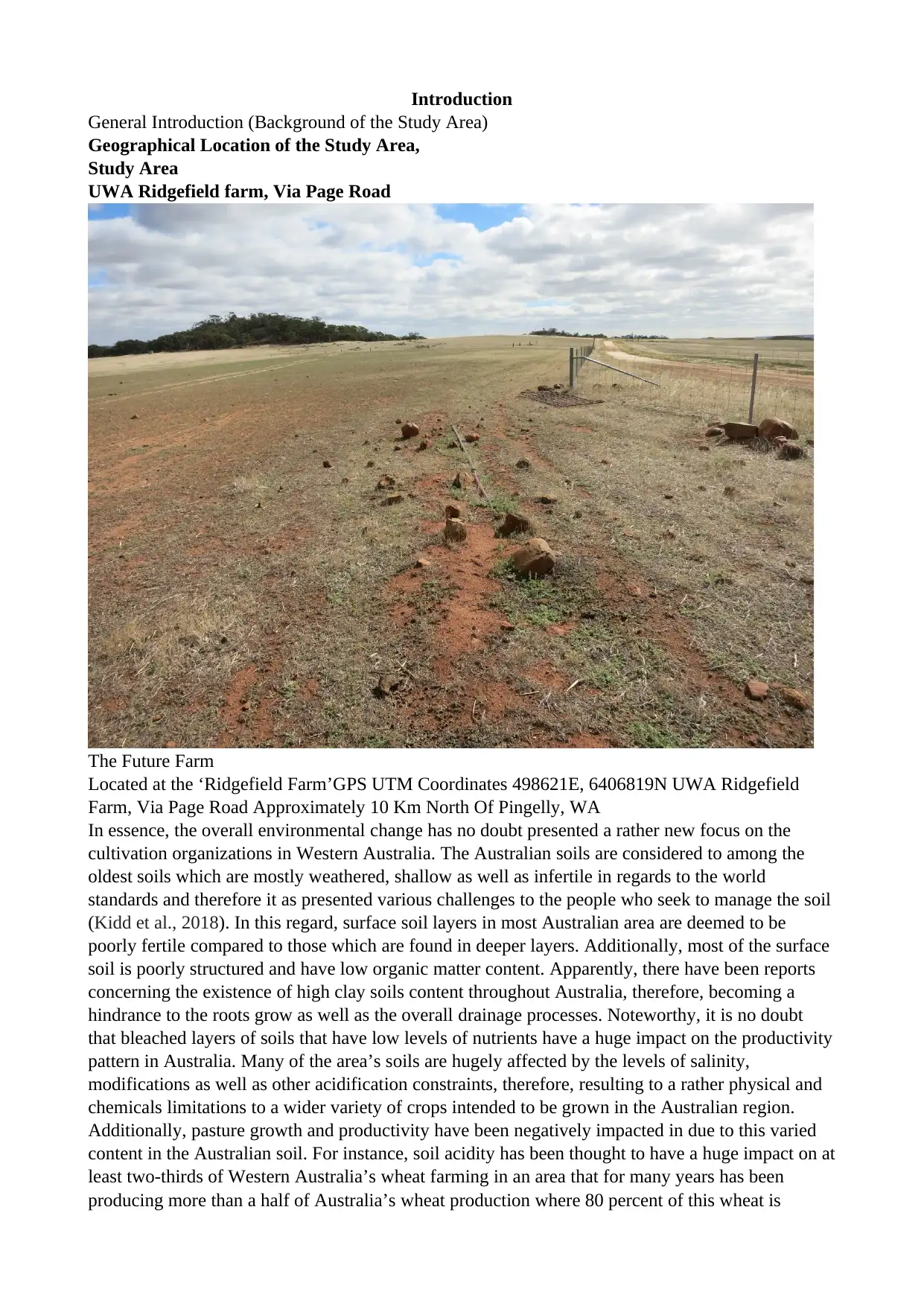
Introduction
General Introduction (Background of the Study Area)
Geographical Location of the Study Area,
Study Area
UWA Ridgefield farm, Via Page Road
The Future Farm
Located at the ‘Ridgefield Farm’GPS UTM Coordinates 498621E, 6406819N UWA Ridgefield
Farm, Via Page Road Approximately 10 Km North Of Pingelly, WA
In essence, the overall environmental change has no doubt presented a rather new focus on the
cultivation organizations in Western Australia. The Australian soils are considered to among the
oldest soils which are mostly weathered, shallow as well as infertile in regards to the world
standards and therefore it as presented various challenges to the people who seek to manage the soil
(Kidd et al., 2018). In this regard, surface soil layers in most Australian area are deemed to be
poorly fertile compared to those which are found in deeper layers. Additionally, most of the surface
soil is poorly structured and have low organic matter content. Apparently, there have been reports
concerning the existence of high clay soils content throughout Australia, therefore, becoming a
hindrance to the roots grow as well as the overall drainage processes. Noteworthy, it is no doubt
that bleached layers of soils that have low levels of nutrients have a huge impact on the productivity
pattern in Australia. Many of the area’s soils are hugely affected by the levels of salinity,
modifications as well as other acidification constraints, therefore, resulting to a rather physical and
chemicals limitations to a wider variety of crops intended to be grown in the Australian region.
Additionally, pasture growth and productivity have been negatively impacted in due to this varied
content in the Australian soil. For instance, soil acidity has been thought to have a huge impact on at
least two-thirds of Western Australia’s wheat farming in an area that for many years has been
producing more than a half of Australia’s wheat production where 80 percent of this wheat is
⊘ This is a preview!⊘
Do you want full access?
Subscribe today to unlock all pages.
Trusted by 1+ million students worldwide
intended for export purposes. In this sense, the Australian farming institution has been costed more
than $400 million as a result of the apparent loss in the production of wheat. Most of the Australian
soils are difficult to manage due to the varied limitations it possesses despite the fact that Australia
has large fertile cracking clays. Nonetheless, overall Australia’s variability of climate has been a
huge contributing factor in the challenges facing soil management for many years now. In this
regard, managing the soil and land in this country needs the availability of sophisticated sort of risk
management structures as well as a high resources of expertise and adaptability.
Apparently, the Australian soil is one of the major assets that belong to the national government,
therefore, underpinning the overall country’s agriculture productivity and the ability to be one of the
main food exporters worth $30 billion every year. Just as assets requires maintenance, so are soil
across the globe. In the quest of boasting food productivity across the world, there is a need for
change in strategies across Australia calling for an intensive soil management program.
Additionally, there is a need for the agriculture sector to manage climatic change and reduce the
greenhouse effect. Apparently, this can be done through reduction of wasteful gas emission in the
entire Australia community and the rest of the world. to achieve this attribute, there would be the
need for formulation of multiple goals in the overall urge of improving soil across Australian region
particularly in Western Australia.
Various credible research has suggested that the Australian soil is likely to be affected by the certain
issues such as the degradation, acidification, erosion as well as the overall loss of the soil carbon
throughout the years. This is projected to have an adverse effect on the Australian agriculture sector
in coming days unless there is a rather carefully management of soil involved. Recent research on
the assessment of the soil condition in regions where cropping and grazing system are undertaken
shows that 50 percent of the soil region were in a rather poor state while at least 95 percent across
the region indicated an immense deterioration in the level of soil PH regarding acidification
(Murphy, 2017). On the other hand, the level of wind and water erosion had taken place in at least
more than 53 percent assessed which meant that there was a poor soil cover across Western
Australia. Additionally, the research indicated that more than 33 percent of the region has a poor
soil carbon content while there was an ongoing deterioration in the level of soil carbon of about 85
percent.
There has been an ongoing threat thanks to the level of dryland salinity although recent drought
tends to halt the spread temporarily. Noteworthy, there has been the process of mining agricultural
soils in Western Australia by many agricultural stores without an apparent replacement of the same.
There have been potential damages to the environmental assets such as the great barrier rifts due to
a clear runoff and the overall loss of top soils from a poor management of soil across Australia. In
essence, this has been deemed to reduce the quality of water that often flows into lagoons.
It is therefore likely that the overall Australian community will have to adapt to a rather improved
capture as well as the uses of soil water and improves the overall nutritional content of soil in an
aim of reducing the over-reliance on the high requirements of the energy for the purpose of
production of organic fertilizers. The agricultural industry will as well be expected to manage those
soils that are kept in the stores so that more carbon can be maintained thus reducing the greenhouse
effect gas emission like those that are associated with the fertilizer.
Primarily for many years now, there has been a direct expectation of the sustainability of food
production and exportation by the Australian government. In this regards, there has been an
intention of the provision of high-quality ecosystem services by the agricultural landscape. Some of
this intention is to have a clean air as well as water, soil and the overall protection of the
biodiversity as well as the protection the protection of the ecosystem. There is a need for a full
insight by the agricultural authority in meeting the challenges facing the aspect of soil in Australia
despite the fact that the region continues to produce world-class soil RD&E.
Paraphrase This Document
Need a fresh take? Get an instant paraphrase of this document with our AI Paraphraser
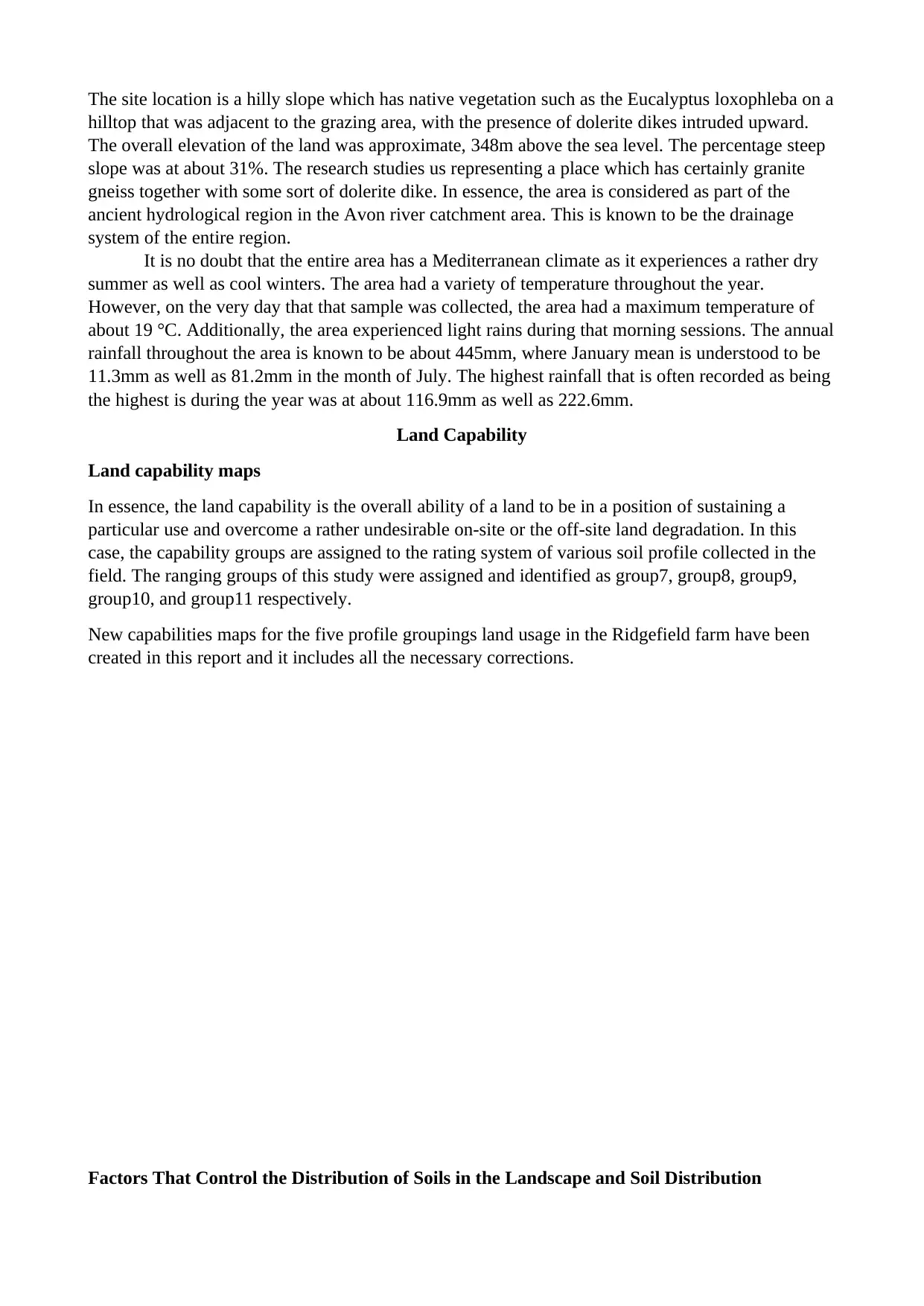
The site location is a hilly slope which has native vegetation such as the Eucalyptus loxophleba on a
hilltop that was adjacent to the grazing area, with the presence of dolerite dikes intruded upward.
The overall elevation of the land was approximate, 348m above the sea level. The percentage steep
slope was at about 31%. The research studies us representing a place which has certainly granite
gneiss together with some sort of dolerite dike. In essence, the area is considered as part of the
ancient hydrological region in the Avon river catchment area. This is known to be the drainage
system of the entire region.
It is no doubt that the entire area has a Mediterranean climate as it experiences a rather dry
summer as well as cool winters. The area had a variety of temperature throughout the year.
However, on the very day that that sample was collected, the area had a maximum temperature of
about 19 °C. Additionally, the area experienced light rains during that morning sessions. The annual
rainfall throughout the area is known to be about 445mm, where January mean is understood to be
11.3mm as well as 81.2mm in the month of July. The highest rainfall that is often recorded as being
the highest is during the year was at about 116.9mm as well as 222.6mm.
Land Capability
Land capability maps
In essence, the land capability is the overall ability of a land to be in a position of sustaining a
particular use and overcome a rather undesirable on-site or the off-site land degradation. In this
case, the capability groups are assigned to the rating system of various soil profile collected in the
field. The ranging groups of this study were assigned and identified as group7, group8, group9,
group10, and group11 respectively.
New capabilities maps for the five profile groupings land usage in the Ridgefield farm have been
created in this report and it includes all the necessary corrections.
Factors That Control the Distribution of Soils in the Landscape and Soil Distribution
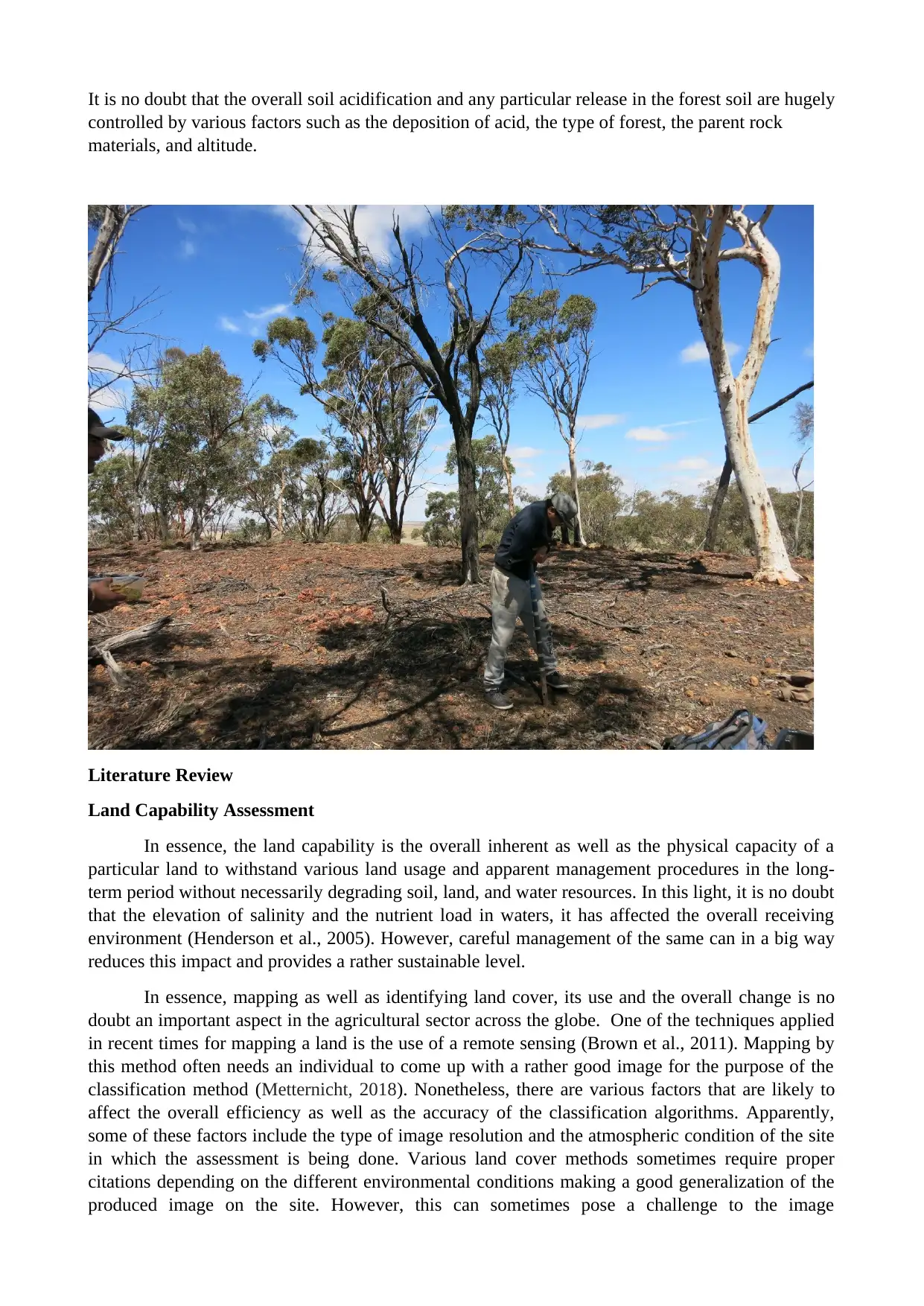
It is no doubt that the overall soil acidification and any particular release in the forest soil are hugely
controlled by various factors such as the deposition of acid, the type of forest, the parent rock
materials, and altitude.
Literature Review
Land Capability Assessment
In essence, the land capability is the overall inherent as well as the physical capacity of a
particular land to withstand various land usage and apparent management procedures in the long-
term period without necessarily degrading soil, land, and water resources. In this light, it is no doubt
that the elevation of salinity and the nutrient load in waters, it has affected the overall receiving
environment (Henderson et al., 2005). However, careful management of the same can in a big way
reduces this impact and provides a rather sustainable level.
In essence, mapping as well as identifying land cover, its use and the overall change is no
doubt an important aspect in the agricultural sector across the globe. One of the techniques applied
in recent times for mapping a land is the use of a remote sensing (Brown et al., 2011). Mapping by
this method often needs an individual to come up with a rather good image for the purpose of the
classification method (Metternicht, 2018). Nonetheless, there are various factors that are likely to
affect the overall efficiency as well as the accuracy of the classification algorithms. Apparently,
some of these factors include the type of image resolution and the atmospheric condition of the site
in which the assessment is being done. Various land cover methods sometimes require proper
citations depending on the different environmental conditions making a good generalization of the
produced image on the site. However, this can sometimes pose a challenge to the image
⊘ This is a preview!⊘
Do you want full access?
Subscribe today to unlock all pages.
Trusted by 1+ million students worldwide
classification process. As a result of this, there has been the urge of innovating new and
sophisticated classification procedures in the contemporary world. However, this method needs a lot
of intensive training as well as human supervisory.
Noteworthy, the aspect of extending mapping as well as the modeling of land use at a
particular period of time in analyzing change will no doubt add more challenges and complexity to
the land assessment procedures. Apart from the above-listed challenge, there is a need for an
efficient method in ensuring that there is a clear comparability as well as the issue of compatibility
of various images that are taken from a certain field where samples are collected. Nonetheless, the
change in the effect of the image sensing in the world of literature has raised eyebrows in recent
time. Various people have been assessing the quality of performance taken using this method give
the aspect of land assessment tool can sometimes be challenging.
Texture analysis is a rather kind of technique of land cover that has been gaining a rather
increased attention in recent times especially from the mote sensing community. The old texture
method of soil analysis has had various applications such as the spatial concurrency of the matrix
and the local variance system of land assessment. The texture sensing system has recently, applied
various application which had not been used when it was first implemented. This has proven
important has it has provided a more accurate classification of the land cover. Some of these
accuracies have been fractals, lacunarity, spatial auto corrections as well as the variograms.
Primarily, land assessment plan has often been used in judging as well as interconnection of
the biophysical imperatives that tend to use the ground and the ecological limitations. Through the
process of grouping, the overall quality of land, land assessment has been an important factor
especially to the organizers, as well as chiefs in arriving at a certain appraisal. In this sense, a higher
review on land is more flexible and provides a bunch of extra options for the utilization of land
across the globe. The assessment system of land can in many ways be used to predict the apparent
levels of production as well as the effect of the use of a particular land. Additionally, this process
can be used to indicate the different levels of management that are required in achieving specified
levels of land production and the rather stands of conservation in the agricultural system (Qureshi &
Harrison, 2017). Any system of land assessment is meant to provide an insight and an analysis of
the components and the physical characteristics of various lands which fail to change appreciably
within a given period of time and therefore can be overlaid with the overall social and the economic
factors which change with a set time frame. In this light, land capability assessment provides
elementary information that is required for the land use across the world. One of the most equitable
types of land capability rating procedure is the use of a table. In this manner, the various land
characteristics considered to have the greatest effect on the overall performance scale are entered in
a table.
Paraphrase This Document
Need a fresh take? Get an instant paraphrase of this document with our AI Paraphraser
Land capability assessment requires various ranges of qualified professionals from different
disciplines. Apparently, LCA should have tertiary guidance and qualifications in a rather sort of
disciplines such as the hydrogeology, science of soil, agricultural science, and geology to make sure
that people are well conversant with the overall accessibility of land and how to maintain it for a
proper and improved productivity across the globe. In this light, the land assessor has to have some
specific strategies for determining all the attributes of a soil and make sure the goal is met during
sampling of various soil factors (Vaudour & Shaw, 2017). In addition, the person who assess a land
has to have a certain level of technical expertise as well as experience with a wide range of inter-
disciplinary fields particularly in the wastewaters management as well as skills in the attribute of
the interpretation of soil, sites as well as the climatic condition while still undertaking the balances
between water and soil nutrients, selection and the design of an appropriate soil treatment plan.
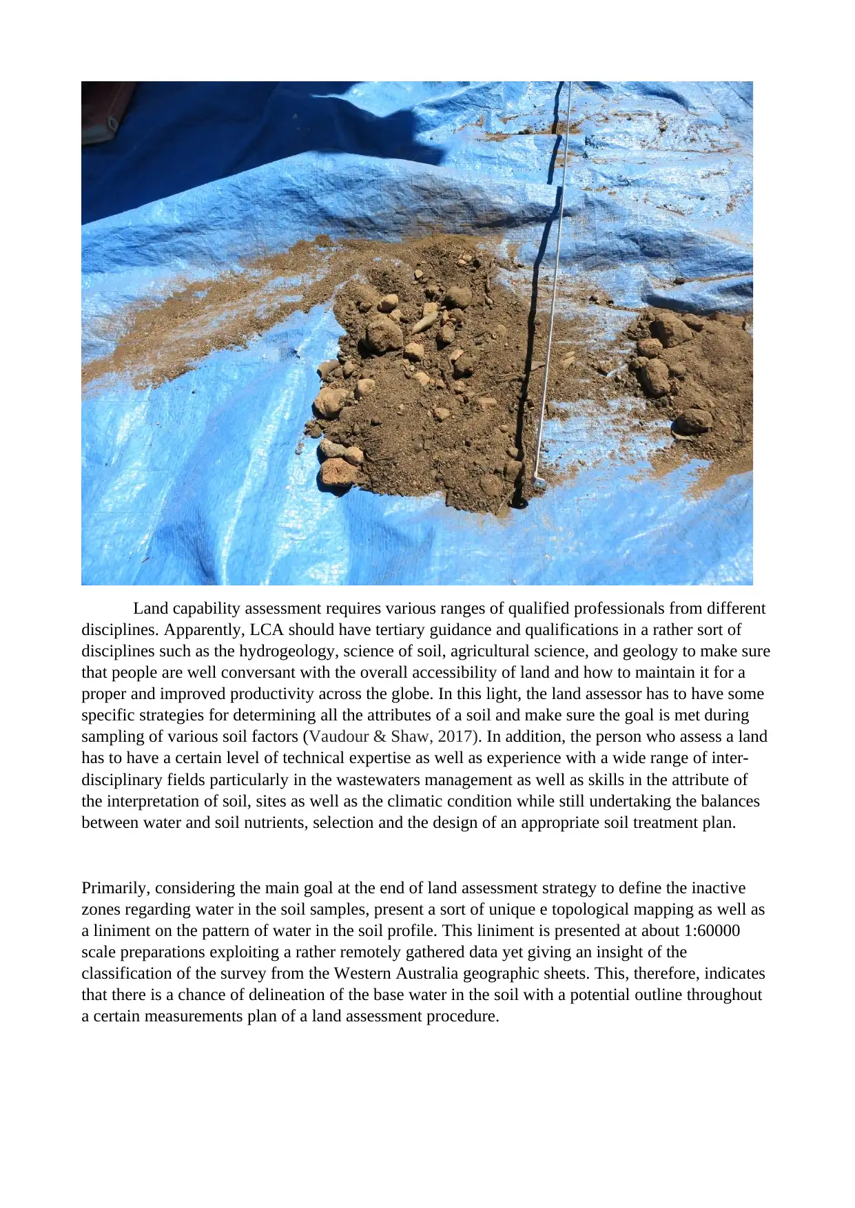
Primarily, considering the main goal at the end of land assessment strategy to define the inactive
zones regarding water in the soil samples, present a sort of unique e topological mapping as well as
a liniment on the pattern of water in the soil profile. This liniment is presented at about 1:60000
scale preparations exploiting a rather remotely gathered data yet giving an insight of the
classification of the survey from the Western Australia geographic sheets. This, therefore, indicates
that there is a chance of delineation of the base water in the soil with a potential outline throughout
a certain measurements plan of a land assessment procedure.
disciplines. Apparently, LCA should have tertiary guidance and qualifications in a rather sort of
disciplines such as the hydrogeology, science of soil, agricultural science, and geology to make sure
that people are well conversant with the overall accessibility of land and how to maintain it for a
proper and improved productivity across the globe. In this light, the land assessor has to have some
specific strategies for determining all the attributes of a soil and make sure the goal is met during
sampling of various soil factors (Vaudour & Shaw, 2017). In addition, the person who assess a land
has to have a certain level of technical expertise as well as experience with a wide range of inter-
disciplinary fields particularly in the wastewaters management as well as skills in the attribute of
the interpretation of soil, sites as well as the climatic condition while still undertaking the balances
between water and soil nutrients, selection and the design of an appropriate soil treatment plan.
Primarily, considering the main goal at the end of land assessment strategy to define the inactive
zones regarding water in the soil samples, present a sort of unique e topological mapping as well as
a liniment on the pattern of water in the soil profile. This liniment is presented at about 1:60000
scale preparations exploiting a rather remotely gathered data yet giving an insight of the
classification of the survey from the Western Australia geographic sheets. This, therefore, indicates
that there is a chance of delineation of the base water in the soil with a potential outline throughout
a certain measurements plan of a land assessment procedure.
Role of the GIS
In the recent technological advancement, geographic information system has no doubt been
rooted in being intellectual practices that have been populated by data as well as power by the
aspect of mathematical analysis. A recent survey indicates that the main application of GIS is
directed for various partial analyses, modeling regarded as predictable, visualization as well as
cartography process. The GIS industry is considered one of the rapidly developing industries across
the globe. GIS is preferred in land assessment study as it tends to map rather accurate locations and
surveys coordinates of a particular object in space, therefore, providing various leads and answers to
questions by the use of computer systems. In this light, GIS is then applied in the collection,
storage, management, analyzing, and production of useful information. In other words, GIS is
mostly used in the process of inputting various data together for the purpose of producing reliable
information. Apparently, CAS tends to rely more on the kind of input of various historical records
as well as utilizing the functionality of the modern GIS in the overall production of predictions and
responses strategies for the world’s natural phenomena.
⊘ This is a preview!⊘
Do you want full access?
Subscribe today to unlock all pages.
Trusted by 1+ million students worldwide

Land use map of ‘Afternoon Group’ study area at UWA Ridgefield Farm
Despite the huge potential of the usage of GIS, there has been a problem regarding the overall
means of assimilating universal roles and the clear influence that the technology has failed to keep
up the pace with the contemporary development as and the ever-changing techniques. In this light,
it is evident that the usage of the GIS has not hit its maximum potentiality since many users are not
aware of the existence of a modern and integrated GIS in various conditions where spatial locations
are required in the process of land mapping (Mrazova et al., 2017). The most desirable function of
the GIS is its ability to input data using a set of selected attributes or rather selections of location
meant for spatial analysis procedure in finding the interconnections between a given set of results.
Paraphrase This Document
Need a fresh take? Get an instant paraphrase of this document with our AI Paraphraser
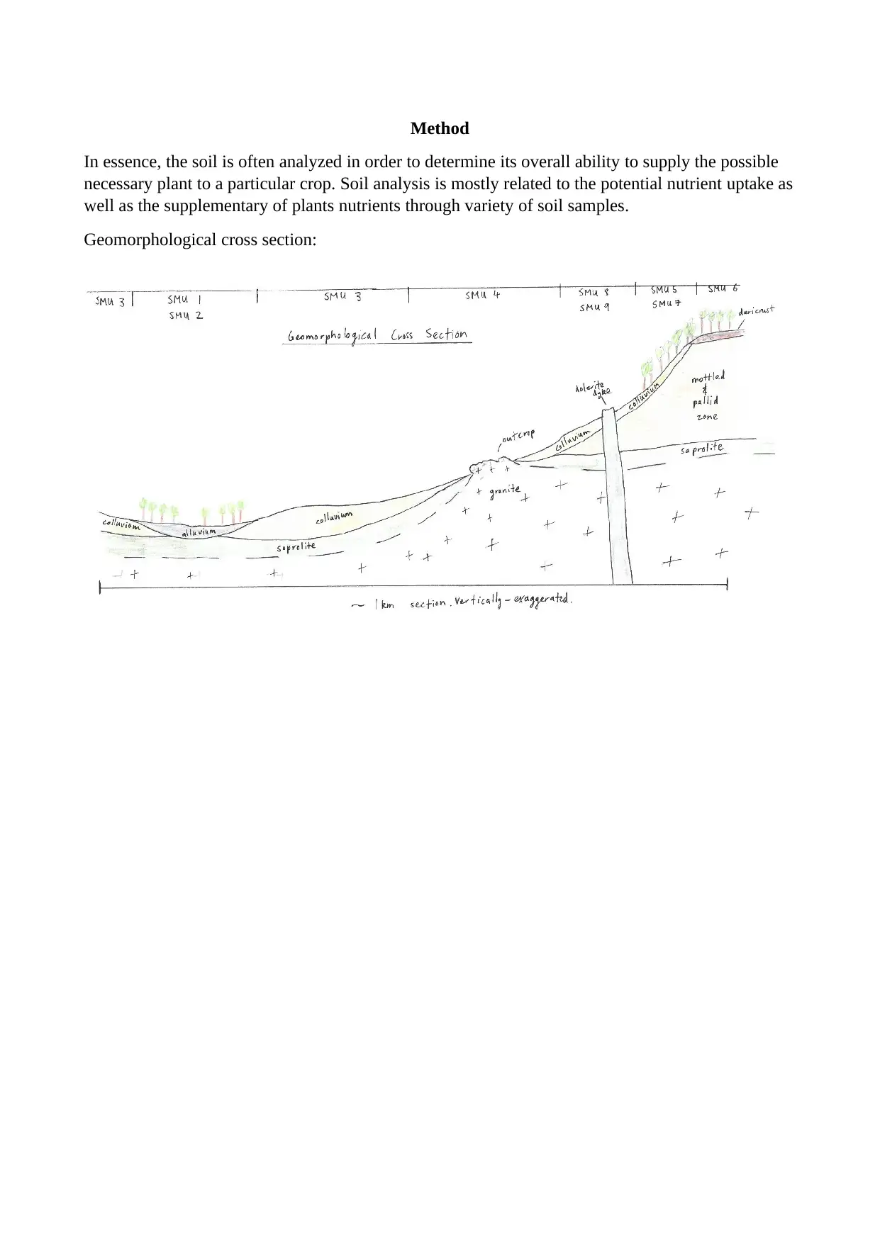
Method
In essence, the soil is often analyzed in order to determine its overall ability to supply the possible
necessary plant to a particular crop. Soil analysis is mostly related to the potential nutrient uptake as
well as the supplementary of plants nutrients through variety of soil samples.
Geomorphological cross section:
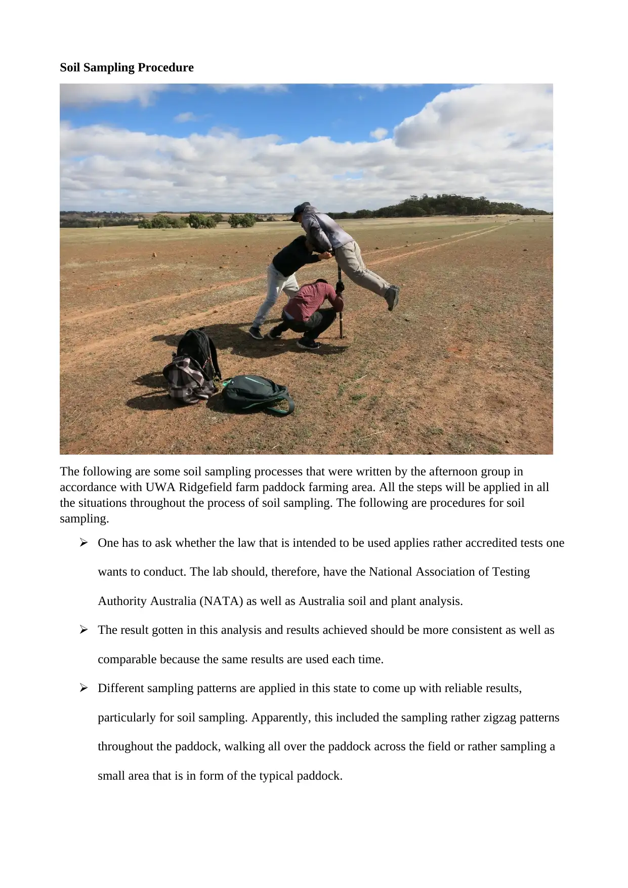
Soil Sampling Procedure
The following are some soil sampling processes that were written by the afternoon group in
accordance with UWA Ridgefield farm paddock farming area. All the steps will be applied in all
the situations throughout the process of soil sampling. The following are procedures for soil
sampling.
One has to ask whether the law that is intended to be used applies rather accredited tests one
wants to conduct. The lab should, therefore, have the National Association of Testing
Authority Australia (NATA) as well as Australia soil and plant analysis.
The result gotten in this analysis and results achieved should be more consistent as well as
comparable because the same results are used each time.
Different sampling patterns are applied in this state to come up with reliable results,
particularly for soil sampling. Apparently, this included the sampling rather zigzag patterns
throughout the paddock, walking all over the paddock across the field or rather sampling a
small area that is in form of the typical paddock.
⊘ This is a preview!⊘
Do you want full access?
Subscribe today to unlock all pages.
Trusted by 1+ million students worldwide
1 out of 45
Your All-in-One AI-Powered Toolkit for Academic Success.
+13062052269
info@desklib.com
Available 24*7 on WhatsApp / Email
![[object Object]](/_next/static/media/star-bottom.7253800d.svg)
Unlock your academic potential
Copyright © 2020–2026 A2Z Services. All Rights Reserved. Developed and managed by ZUCOL.