Exploring Recent Advances in Remote Sensing for Mangrove Forests
VerifiedAdded on 2023/06/04
|13
|2765
|207
Literature Review
AI Summary
This literature review examines recent advancements in remote sensing techniques applied to the study of mangrove forests. It discusses various methods, including wavelength nanometer analysis, mapping and monitoring, satellite remote sensing using Landsat data, visual interpretation of high-res...
Remote sensing in the study of mangrove forest.
Name
Professor
Course
Date
[Type here]
Name
Professor
Course
Date
[Type here]
Paraphrase This Document
Need a fresh take? Get an instant paraphrase of this document with our AI Paraphraser
Introduction.
Remote sensing has been used to gather information about mangrove ecosystem by using
technology that does not involve direct contact with the object being investigated since
mangrove forest are Mostly located in the very inaccessible area, an example is in figure 1 and
2 below. Remote sensing has enabled monitoring and mapping this mangrove ecosystem that is
on the verge of extinction. Many research has been done and conducted around the world
especially in tropics and subtropics mangrove forests. Due to the hidden importance of these
mangrove species which have not been fully exploited , there is need to identify the most
suitable remote sensing technique that is suitable for data collection and what needs to be
improved on the existing technology for effective data collection.
[Type here]
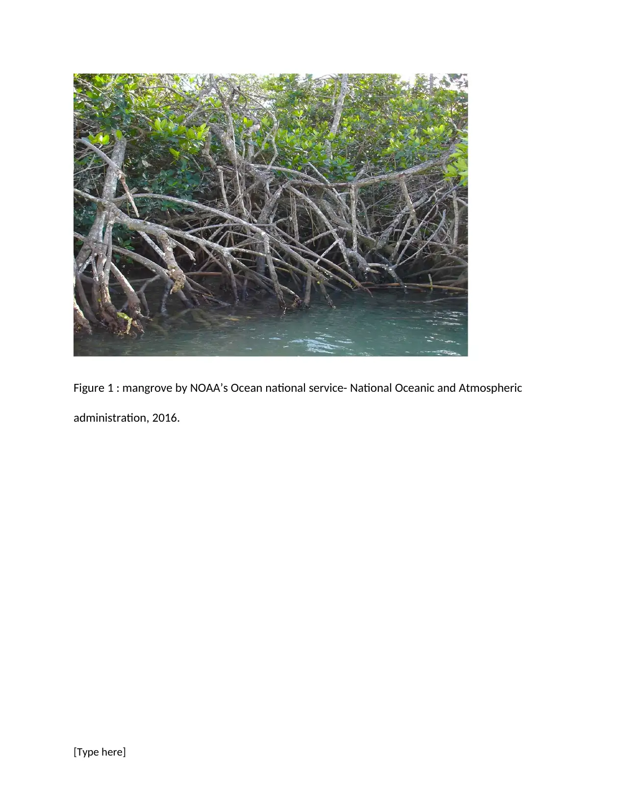
Figure 1 : mangrove by NOAA’s Ocean national service- National Oceanic and Atmospheric
administration, 2016.
[Type here]
administration, 2016.
[Type here]
⊘ This is a preview!⊘
Do you want full access?
Subscribe today to unlock all pages.

Trusted by 1+ million students worldwide
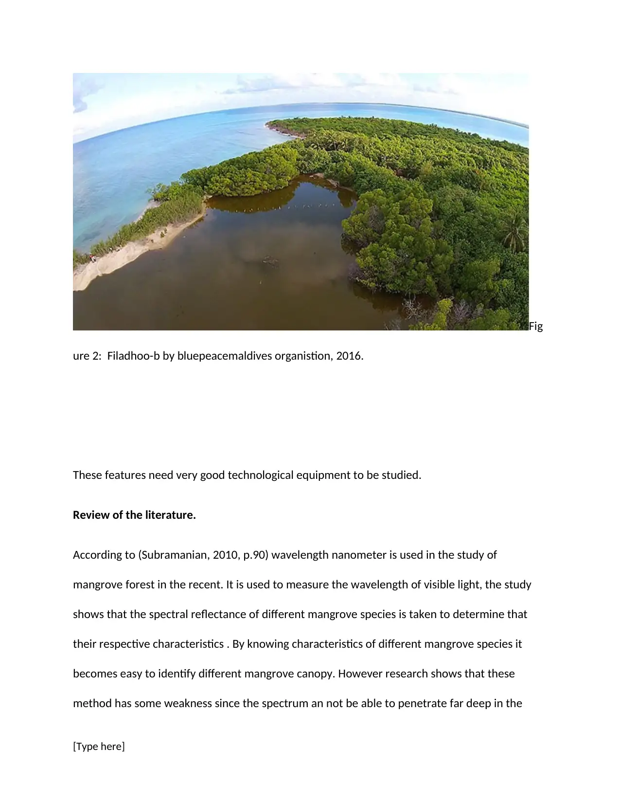
Fig
ure 2: Filadhoo-b by bluepeacemaldives organistion, 2016.
These features need very good technological equipment to be studied.
Review of the literature.
According to (Subramanian, 2010, p.90) wavelength nanometer is used in the study of
mangrove forest in the recent. It is used to measure the wavelength of visible light, the study
shows that the spectral reflectance of different mangrove species is taken to determine that
their respective characteristics . By knowing characteristics of different mangrove species it
becomes easy to identify different mangrove canopy. However research shows that these
method has some weakness since the spectrum an not be able to penetrate far deep in the
[Type here]
Paraphrase This Document
Need a fresh take? Get an instant paraphrase of this document with our AI Paraphraser
ocean and thus mangrove species deep below have not yet been explored fully
(CHAUDHURI,2013, p.56)
Mapping and monitoring is another method used in remote sensing of mangrove forest in the
world, the research made by (Kigomo, 2010, p.84) Applying remote sensing technique shifting
wetland vegetation. He states that the mapping and monitoring is the best approach in
mangrove remote sensing ,when it comes in dealing with various imagery , general land cover
and the activities within the ecosystem ,we find that we are able to detect things such as
mangrove deforestation ,and it can also be caused by various activities such as agriculture and
orchards ,establishment of pipeline networks and also the establishment of shrimp ponds in the
this tropic region ,This enables us to get full data concerning mangrove forests but in contrary
we find in the process some places may not be covered and detected as the region may be vast
and also the swampy region may hinder the researchers from reaching there and it is according
to (Torra, 2011, p.67)
According to(Valiela, I., Bowen, J.L. and York, J.K., 2011, p.805) ,satellite remote sensing and
Landsat is another method involved in remote sensing ,he states that Landsat is another
sensing technique that has been widely used due to its accessibility ,data and images from
Landsat has enabled qualifying and noting changes of these mangrove across the globe . This
method makes use of mangrove regression trees (CART), support vector machine, (SVM ),
object-oriented classification during the study. However these only provides a snapshot
because of the extensive mangrove region and the massive scale of work involved in mapping,
in contrary we also find that this method is faced with challenges and there is need for
[Type here]
improvement, according to (Ramsey and Jansen, 1996) the researchers can be threatened by
bad weather and the endangered wild animals in this tropic region, this makes them not to
cover other species.
According to a research done in the United States of America by (Giri, C., Pengra, B., Zhu, Z.,
Singh, A. and Tieszen, L.L., 2014,p.75), visual interpretation from the high-resolution image has
played an important role in the study of mangrove community in the coastal shoreline. It has
been widely used to disclosure the position of mangrove forest, its spectrum and the texture of
the data. Visual interpretation makes use of high-resolution imagery such as Ikanos and aerial
photographs. Spatial resolution ranging from 20m – 5m from a high-resolution imagery gives a
clear information about mangrove interpretation.However, these information requires proper
classification, applying cluster and algorithms to label the images with land cover type (Giri, C.,
Pengra, B., Zhu, Z., Singh, A. and Tieszen, L.L., 2014,p.95). Despite these classifications, there
are still of some section of the mangrove cover that has not been explored because this method
is time-consuming and requires a lot of skills and techniques to facilitate accuracy of the data.
Radio detection and ranging system is a method for the detection and ranging of earth surface
features and has been widely employed in the study of mangrove forest. Radar being an active
and remote sensing system that provides its own source of energy to produce an image of a
high resolution, Radar has its own electromagnetic radiation source, which is then directed to
one particular place on the earth surface and its energy reflected back from the surface and
recorded. (Heumann, B.W., 2011,p Heumann, B.W., 2011,p.105).According to the USA
Department of radio technology, a radar has special properties that make it viable as a remote
[Type here]
⊘ This is a preview!⊘
Do you want full access?
Subscribe today to unlock all pages.

Trusted by 1+ million students worldwide
sensing technique. It has the ability to produce images through hail, fog, rain smoke, and even
clouds. It does not depend on daylight to function at all and will remain to be used as a reliable
method of studying mangrove forest. However, some geologist argues that radar is not often
reliable because it only used to view a picture on the earth surface and thus cannot be used
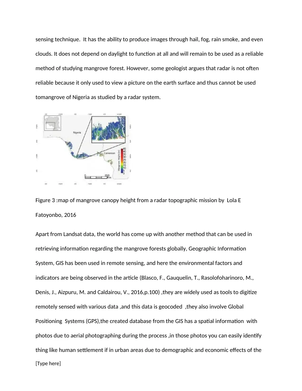
tomangrove of Nigeria as studied by a radar system.
Figure 3 :map of mangrove canopy height from a radar topographic mission by Lola E
Fatoyonbo, 2016
Apart from Landsat data, the world has come up with another method that can be used in
retrieving information regarding the mangrove forests globally, Geographic Information
System, GIS has been used in remote sensing, and here the environmental factors and
indicators are being observed in the article (Blasco, F., Gauquelin, T., Rasolofoharinoro, M.,
Denis, J., Aizpuru, M. and Caldairou, V., 2016,p.100) ,they are widely used as tools to digitize
remotely sensed with various data ,and this data is geocoded ,they also involve Global
Positioning Systems (GPS),the created database from the GIS has a spatial information with
photos due to aerial photographing during the process ,in those photos you can easily identify
thing like human settlement if in urban areas due to demographic and economic effects of the
[Type here]
Paraphrase This Document
Need a fresh take? Get an instant paraphrase of this document with our AI Paraphraser
region, secondly, you can also identify natural resources and this is only achieved by the
favorable climatic condition in the region(Singh, A., 2015,p.20). GIS is also a valuable tool in
environmental planning , impact assessment and disaster management without forgetting it
also has an upper hand in managerial function in the management since various proposed
treatments can be can now be entered and summarized thus providing useful overview for
planning ,implementation and monitoring ,( Boyd, D.S. and Foody, G.M., 2011,p.27) in The
proposed integrated forests management ,in contrary even if the aerial photographs are used
and it in addition gives us the spatial information in the mangrove forests ,it remains an
extraordinary and difficult method of remote sensing especially in diverse environments like
tropical coastal ecosystem ,( Blaschke, T., 2011,p.17) . We are also told that the adverse
weather conditions from the tropics make it harder for the researchers to cover the
region ,some region may be infested with invertebrates such as tsetse flies and bees hence
making them avoid those places ,secondly we are told that the tropic and subtropics regions
are mainly covered with water hence making the environment to look swampy and
unbearable for individuals to carry on their tasks diligently .S o I hereby suggest that the world
should come up with a well improvised gadgets to assist in mangrove remote sensing other
than relying on GIS &GPS ,this will enable them to cover up more mangrove regions. (Lillesand,
T., Kiefer, R.W. and Chipman, J., 2014,p.4)
In Mexico, Principal investigator Dr.Octavio Aburto has gone an extra mile to conduct research
on the conservation of mangrove forest using Drones. He clearly states that drones are able to
work quickly and efficiently in comparison to tedious groundwork. He conducted several study
on the mangrove forest using drones which helped him map mangrove from above while flying
[Type here]
at a low height taking picture of 3d model which he later would use to identify mangrove
species . The data enabled him understand mangrove composition in terms of species and
biomass. The main purpose of these research was to try and avoid deforestation of mangrove
species which was occurring at a very fast rate of 1-2% a year. However, the research did not
mention the kind of mangrove species that was investigated neither did it mentioned in the
composition of the biomass. Moreover, drones have got limitation because it cannot work and
severe condition such as, high temperature, heavy rains and strong wind and thus can slow
down the process of research. In my own opinion, there is need to come up with more complex
drone that will be able to carry out research despite the climatic conditions.
The other method used in remote sensing is the use of an electronic library which in most case
deals with the environmental sciences and geography as a whole, the information from states
mangrove forests are evergreen estuarine and they vary in salinity harsh coastal conditions, an
anthropogenic activity postulates that the primary cause of mangrove depletion and
destruction is deforestation, (Richards, J.A. and Richards, J.A., 2016,p.40) ,all this information
are recorded in the library electronically , and it also enables learners to find information
without traveling to the place ,but in contrary we find that the information varies time by time
as they depend on anthropologists to feed them with data, and this may take longer,and in
addition different libraries have different information regarding mangrove forest as they
approach different edition without noting changes that may be undergoing in the tropic
regions, and also their system may fail and loss the information which may be needed recently.
Here our wish is that the government should come up with proper work schedule to improve
[Type here]
⊘ This is a preview!⊘
Do you want full access?
Subscribe today to unlock all pages.

Trusted by 1+ million students worldwide
their library system to enable people to access the information they wish to get about
mangrove forests.
Conclusion
In the past decade, remote sensing has been widely used in the study of mangrove ecosystem
but we cannot conclude that it has been that effective because some researchers have
questioned its application.
To begin with, Poisy claims in his book that radar system image especially those taken from
the SAR system are much difficult to interpret thus does don't give clear outcome about the
mangrove ecosystem. A research by the name Green also does not find the use of aerial
photograph effective because there are only a few materials has been written and published
about mangrove ecosystem. He further argues that this has been due to the improper
publication of those images taken from aerial photography.
Blasco also states in his articles that data collected from remote sensing equipment is likely to
have some errors since most of them don't operate under severe climatic condition. He states
that most of the coastal areas experience heavy flooding due high tides, cyclone and deadly
tsunami which hinder collection of accurate data and therefore there much to be exploited
about mangrove ecosystem that has not been exploited.
Nevertheless, a ground survey is necessary to give a clear overview of the mangrove ecosystem
before one think of exploiting other methods of collecting data and these will help gather
accurate data.
[Type here]
Paraphrase This Document
Need a fresh take? Get an instant paraphrase of this document with our AI Paraphraser
Reference.
Blaschke, T., 2011. What's wrong with pixels? Some recent developments interfacing remote
sensing and GIS. GeoBIT/GIS, 6, pp.12-17.
Blasco, F., Gauquelin, T., Rasolofoharinoro, M., Denis, J., Aizpuru, M. and Caldairou, V., 2016.
Recent advances in mangrove studies using remote sensing data. Marine and Freshwater
Research, 49(4), pp.287-296.
Bluepeacemaldives organistion, 2016, Filadhoo-b , digital image, viewed 25 October
2018.http://goo,gl/images/4M
Boyd, D.S. and Foody, G.M., 2011. An overview of recent remote sensing and GIS-based
research in ecological informatics. Ecological Informatics, 6(1), pp.25-36.
CHAUDHURI, A., 2013. EGO-BIOLOGICAL APPROACH TO SITE SELECTION FOR ENVIRONMENTAL
FORESTS. In Proceedings of Workshop on" Modern Techniques of Site Identification for
Afforestation and Pasture Development", October 21 & 22, 1981 (p. 177). The Society.
data. International journal of remote sensing, 10(6), pp.989-1003.
Fatoyinbo , 2016,map of mangrove canopy height from a radar topographic mission – Research
Gate, <http://www.researchgate.net/publication>
Giri, C., Pengra, B., Zhu, Z., Singh, A. and Tieszen, L.L., 2014. Monitoring mangrove forest
dynamics of the Sundarbans in Bangladesh and India using multi-temporal satellite data from
1973 to 2000. Estuarine, coastal and shelf science, 73
[Type here]
Heumann, B.W., 2011. Sa1-2), pp.91-100.telling remote sensing of mangrove forests: Recent
advances and future opportunities. Progress in Physical Geography, 35(1), pp.87-108.
Kigomo, B.N., 2010. Research and development of Bamboo, Rattan and mangrove forests
research in Kenya and Thailand.
Lillesand, T., Kiefer, R.W. and Chipman, J., 2014. Remote sensing and image interpretation. John
Wiley & Sons.
NOAA’s Ocean national service 2016, Mangrooveve- National Oceanic and Atmospheric
administration, viewed 25 October
2018.<https://oceanservices.noaa.gov/facts/mangroove.jpg>
Richards, J.A. and Richards, J.A., 2016. Remote sensing digital image analysis (Vol. 3)
Singh, A., 2015. Review article digital change detection techniques using remotely sensed
Subramanian, D., 2010. Cytological studies of some mangrove flora of Tamilnadu. Cytologia,
53(1), pp.87-92.
Torra, R., 2011. Application of LANDSAT TM 5 images to supervised and non-supervised
classifications in the northeastern region of Argentina (South America). Creating proxies to
automatic natural resources monitoring in mid-detail scales.
Valiela, I., Bowen, J.L., and York, J.K., 2011. Mangrove Forests: One of the World's Threatened
Major Tropical Environments: At least 35% of the area of mangrove forests has been lost in the
[Type here]
⊘ This is a preview!⊘
Do you want full access?
Subscribe today to unlock all pages.

Trusted by 1+ million students worldwide
past two decades, losses that exceed those for tropical rainforests and coral reefs, two other
well-known threatened environments. AIBS Bulletin, 51(10), pp.807-815.
.
[Type here]
well-known threatened environments. AIBS Bulletin, 51(10), pp.807-815.
.
[Type here]
1 out of 13
Your All-in-One AI-Powered Toolkit for Academic Success.
+13062052269
info@desklib.com
Available 24*7 on WhatsApp / Email
![[object Object]](/_next/static/media/star-bottom.7253800d.svg)
Unlock your academic potential
© 2024 | Zucol Services PVT LTD | All rights reserved.

