Residential Survey and Development: CW2 Assignment - Survey and Plans
VerifiedAdded on 2020/07/22
|28
|3096
|302
Homework Assignment
AI Summary
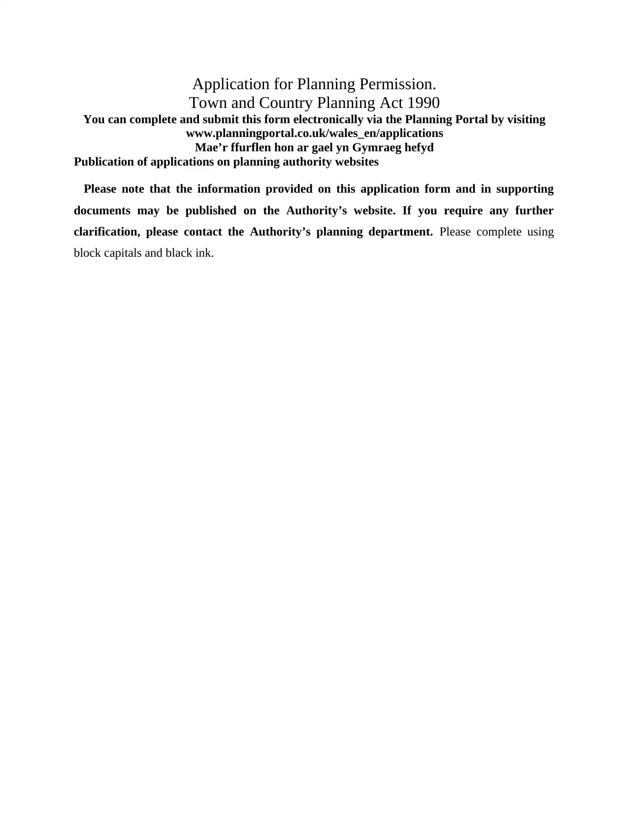
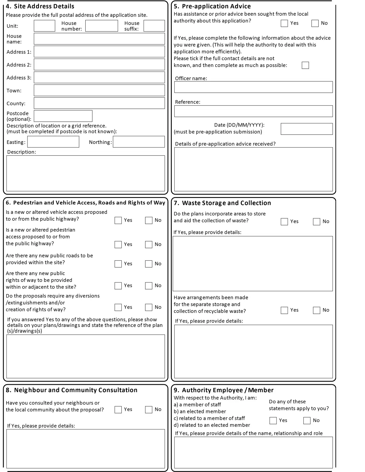
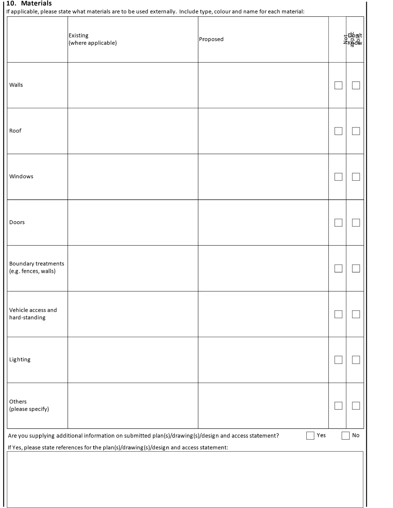
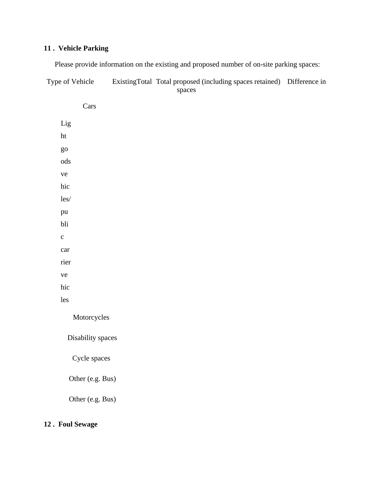
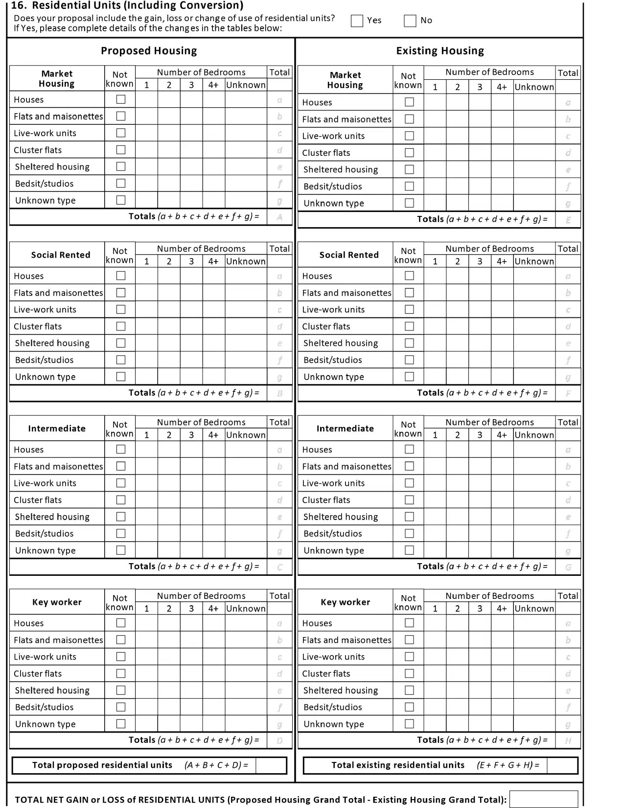
This assignment delves into various aspects of residential surveying and development. It begins with a survey plan, outlining the process of property evaluation, including site visits, consultations, and surveyor selection. The document then explores a proposal for converting a two-story house into three self-contained residential units, detailing pre-application advice, planning processes, and considerations for wheelchair accessibility. The assignment also touches on the use of Ordnance Survey maps, application planning for permission, and the application form for Building Regulations approval. It covers vehicle parking, foul sewage disposal, biodiversity considerations, tree surveys, and trade effluent, as well as the necessary documentation and checklists for planning applications. Finally, it includes the building regulations approval form, detailing applicant information, work descriptions, and electrical work specifications.

RESIDENTIAL SURVEY
AND DEVELOPMENT
AND DEVELOPMENT
Paraphrase This Document
Need a fresh take? Get an instant paraphrase of this document with our AI Paraphraser

TABLE OF CONTENTS
PART 3 (CW2)................................................................................................................................1
Question 1: Survey Plan...................................................................................................................1
Question 2........................................................................................................................................1
Question 3........................................................................................................................................1
Question 4........................................................................................................................................1
Question 5........................................................................................................................................1
Question 7: Application Planning for Permission...........................................................................1
Question 8: Application form for Building Regulations Approval...............................................20

PART 3 (CW2)
Question 1: Survey Plan
In order to survey plan at the initially, the ground or property is to be visited by the buyer
and analyses durability of the house. Along with this, location as well as characteristics of
the property are also identified by the buyer who is going to purchase it.
Further, the buyer will convey and consult up to the surveying. In this, valuation of the
cited property will be done with the help of authority frameworks. In addition to this,
After that, buyer will be select a particular surveyor who know appropriate and proper
knowledge of the land survey in proper manner.
At the last of, surveyor allowed in order to give outline and perform the overall survey.
Under this, number of rooms, kitchen, bathrooms etc. are included. Along with this,
quality of raw materials which is used in order to construct the house is also checked and
surveyed by the surveyor.
Question 2
The proposal includes identifying the background, location and description of the house
which includes the people and their religious, traditions and values which effect the
individual to select the location of the building. After that pre application advise are done
which includes extension of floor and sealing as the advice are done proposed application
form is filled for taking the permission from the government executive to extend it into three
fully self-contained residential units. This process includes making pre proposal and
planning to identify the place where the building is extended till taking application from the
authority and the finally continue the construction for implementation of the proposal.
Question 3
The current house of 2 storey extension has the adequate space in order to convert it into
three units.
1
⊘ This is a preview!⊘
Do you want full access?
Subscribe today to unlock all pages.

Trusted by 1+ million students worldwide

Question 4
In the building, one flat is completely constructed for wheel chair users so they do not get
troubled. There is proper space for them and client can visit the residential part without intruding
into it. Though their is requirement of exertion so that they both can perform their work easily.
Question 5
In a building, various kinds of facility are required to those people who require
wheelchair for making any movement. Building need to develop elevator stair so that it is useful
to the handicapped person to move easily. Innovation can take place in the form of widened
opening, wheelchair timing circles etc. so that it is beneficial for the person.
QUESTION 6: ORDNANCE MAPS
It is national map agency of United Kingdom which is public limited company for
providing secretary of State for businesses. However, it is of two kinds like; large scale and small
scale in which large scale covers 500 maps of urban area. While, for small scale mapping,
covered area is of 1:250,000 road maps. Including this, copyright on these maps are obtained that
maintain its uniqueness for protection securely. Thus, ordnance survey map is useful for
understanding covered island of Great Britain in brief.
Question 7: Application Planning for Permission
2
Paraphrase This Document
Need a fresh take? Get an instant paraphrase of this document with our AI Paraphraser

Application for Planning Permission.
Town and Country Planning Act 1990
You can complete and submit this form electronically via the Planning Portal by visiting
www.planningportal.co.uk/wales_en/applications
Mae’r ffurflen hon ar gael yn Gymraeg hefyd
Publication of applications on planning authority websites
Please note that the information provided on this application form and in supporting
documents may be published on the Authority’s website. If you require any further
clarification, please contact the Authority’s planning department. Please complete using
block capitals and black ink.

⊘ This is a preview!⊘
Do you want full access?
Subscribe today to unlock all pages.

Trusted by 1+ million students worldwide

Paraphrase This Document
Need a fresh take? Get an instant paraphrase of this document with our AI Paraphraser


11 . Vehicle Parking
Please provide information on the existing and proposed number of on-site parking spaces:
Type of Vehicle ExistingTotal Total proposed (including spaces retained) Difference in
spaces
Cars
Lig
ht
go
ods
ve
hic
les/
pu
bli
c
car
rier
ve
hic
les
Motorcycles
Disability spaces
Cycle spaces
Other (e.g. Bus)
Other (e.g. Bus)
12 . Foul Sewage
⊘ This is a preview!⊘
Do you want full access?
Subscribe today to unlock all pages.

Trusted by 1+ million students worldwide

Please state how foul sewage is to be disposed of:
Mains sewer Cess pit Package treatment plant Septic tank
Other
Are you proposing to connect to the existing drainage system? Yes No
If Yes, please include the details of the existing system on the application drawings and state
references for the plan(s)/drawing(s):
13. Biodiversity and Geological Conservation
To assist in answering the following questions refer to the guidance notes on the Planning Portal
website (see “Local level requirements and additional documentation”). The notes provide
further information on when there is a reasonable likelihood that any important biodiversity or
geological conservation features may be present or nearby and whether they are likely to be
affected by your proposals. Having referred to the guidance notes, is there a reasonable
likelihood of the following being affected adversely or conserved and enhanced within the
application site, or on land adjacent to or near the application site?
a) Protected and priority species: b) Designated sites, important habitats or c) Features of
geological conservation other biodiversity features:
importance:
Yes, on the development siteYes, on the development siteYes, on the development site
Yes, on land adjacent to or near the Yes, on land adjacent to or near the Yes, on land
adjacent to or near the
proposed developmentproposed developmentproposed development
NoNoNo
Supporting Information Requirements
Where a development proposal is likely to affect features of biodiversity or geological
conservation interest, you will need to submit, with the application, sufficient information and
assessments to allow the local planning authority to determine the proposal.
Paraphrase This Document
Need a fresh take? Get an instant paraphrase of this document with our AI Paraphraser

Failure to submit all information required will result in your application being deemed invalid. It
will not be considered valid until all information required by the Local Planning Authority has
been submitted.
Your Local Planning Authority will be able to advise on the content of any assessments that may
be required.
14. Trees and Hedges 15. Trade Effluent
Are there trees or hedges on the Does the proposal involve the need to
proposed development site? Yes No dispose of trade effluents or waste? Yes No
And/or: Are there trees or hedges on land adjacent to the If Yes, please describe the nature,
volume and means of disposal proposed development site that could influence the of
trade effluents or waste development or might be important as part
of the local landscape character? Yes No
If Yes to either or both of the above, you may need to provide a full
Tree Survey, at the discretion of your
local planning authority. If a Tree
Survey is required, this and the
accompanying plan should be
submitted alongside your application.
Your local planning authority should
make clear on its website what the
survey should contain, in accordance
with the current 'BS5837: Trees in
relation to design, demolition and
construction - Recommendations'.

⊘ This is a preview!⊘
Do you want full access?
Subscribe today to unlock all pages.

Trusted by 1+ million students worldwide
1 out of 28
Your All-in-One AI-Powered Toolkit for Academic Success.
+13062052269
info@desklib.com
Available 24*7 on WhatsApp / Email
Unlock your academic potential
Copyright © 2020–2026 A2Z Services. All Rights Reserved. Developed and managed by ZUCOL.


