Soil Mechanics Lab: Classifying Soil Using the USCS Method
VerifiedAdded on 2023/06/04
|6
|835
|296
Practical Assignment
AI Summary
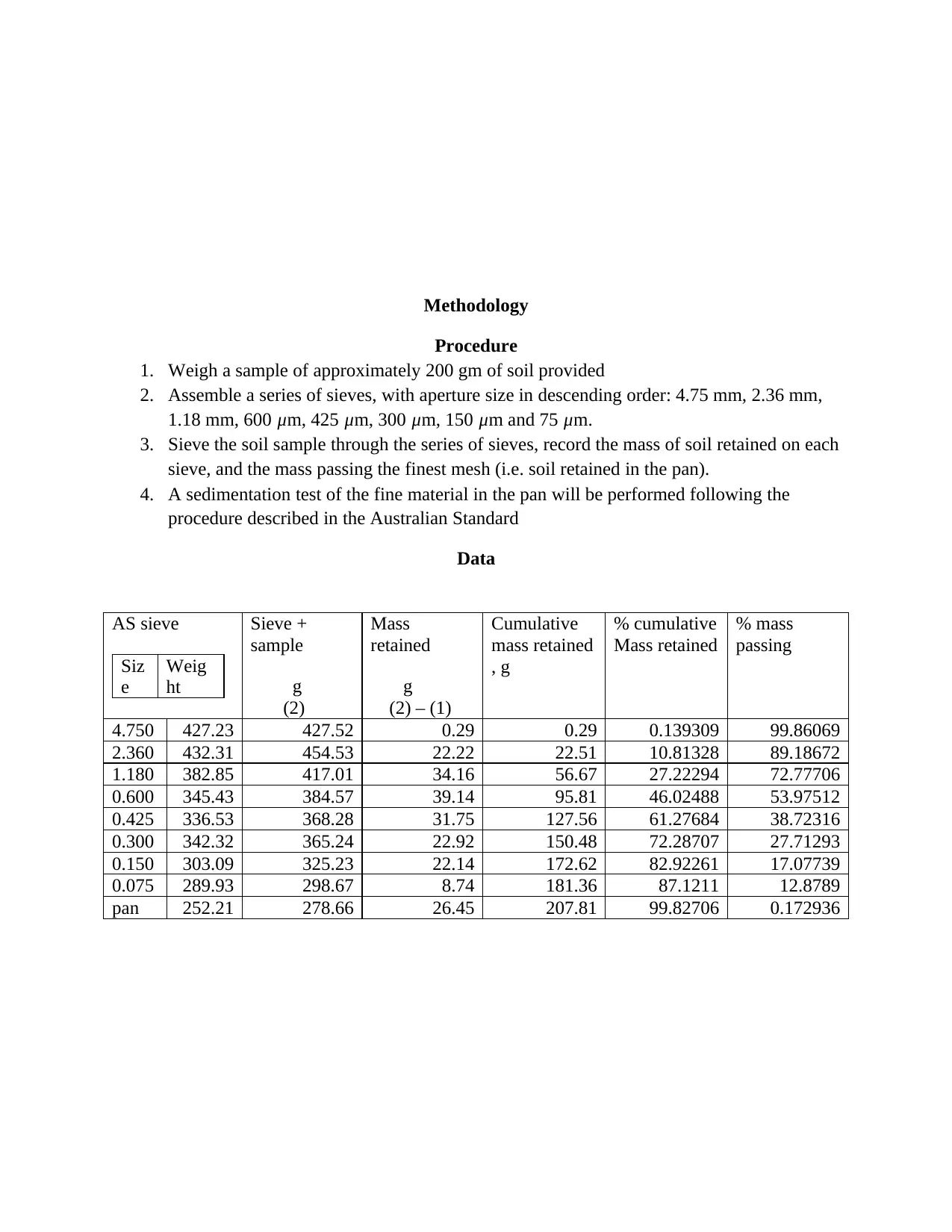
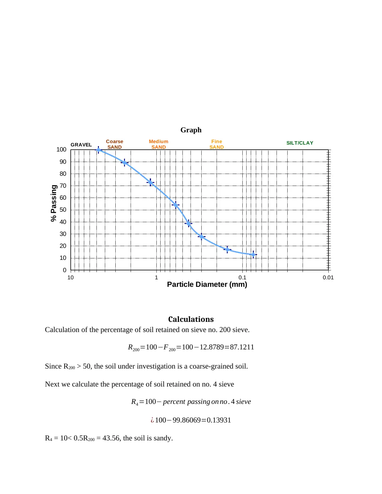
This practical assignment focuses on classifying a coarse-grained soil sample using the Unified Soil Classification System (USCS). The methodology involves conducting a sieve analysis and sedimentation test to determine the particle size distribution. The assignment details the procedure, including weighing the soil sample, sieving it through a series of sieves with decreasing aperture sizes, and recording the mass retained on each sieve. Calculations are performed to determine the percentage of soil retained on sieve no. 200 and sieve no. 4, leading to the conclusion that the soil is sandy. The assignment references established handbooks for soil classification, emphasizing the importance of accurate soil characterization for construction and engineering purposes. Desklib provides access to similar solved assignments and past papers for students.
1 out of 6
Related Documents


Your All-in-One AI-Powered Toolkit for Academic Success.
+13062052269
info@desklib.com
Available 24*7 on WhatsApp / Email
![[object Object]](/_next/static/media/star-bottom.7253800d.svg)
Copyright © 2020–2025 A2Z Services. All Rights Reserved. Developed and managed by ZUCOL.