Urban Growth and Land Use Change Detection in Bandar Abbas City using Remote Sensing
Added on 2023-06-10
9 Pages1098 Words192 Views
1
Name:
Course
Professor’s name
University name
City, State
Date of submission
Name:
Course
Professor’s name
University name
City, State
Date of submission
2
Introduction
Bandar Abbas City is located in the South of Iran. Bandar Abbas City in Iran has experienced
urban growth that has led to change in its land use from 1956 to 2015 (Cervero, 2018). This
study purposes to examine the process of urban growth using remote sensing during this time.
Urban region area of Bandar Abbas city has changed from 402.6 to 5343.59 hectares between
1956 and 2015 and the population has increased more than 30 times in the last seventy years.
Due to structural and natural limitations , more than 78% of the land is barren , beach zones,
stone cliffs , and arable lands are taken up by built up areas. For sustainable and balanced
development to be realized in this city there must be control of the irregular expansion of the city
(Hegazy and Kaloop, 2015).
3
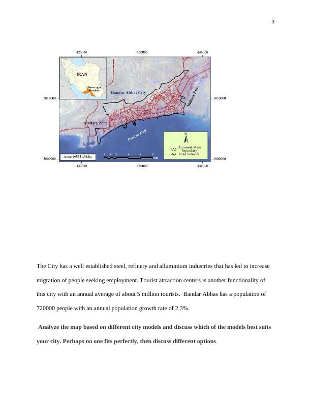
The City has a well established steel, refinery and alluminium industries that has led to increase
migration of people seeking employment. Tourist attraction centers is another functionality of
this city with an annual average of about 5 million tourists. Bandar Abbas has a population of
720000 people with an annual population growth rate of 2.3%.
Analyze the map based on different city models and discuss which of the models best suits
your city. Perhaps no one fits perfectly, then discuss different options.
End of preview
Want to access all the pages? Upload your documents or become a member.