Urban Expansion Analysis of Bandar Abbas City Using Remote Sensing
VerifiedAdded on 2023/06/10
|9
|1098
|192
Report
AI Summary
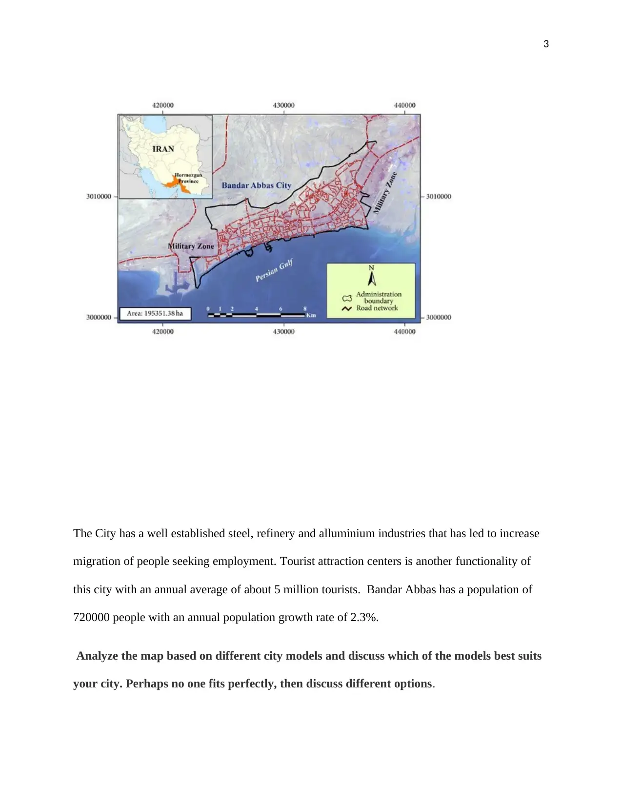
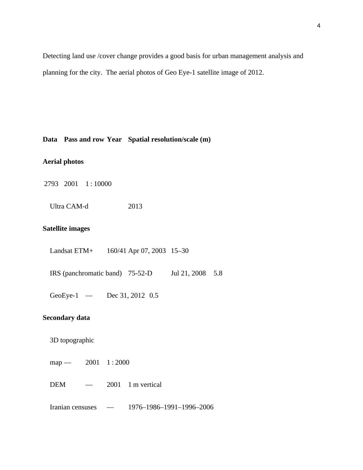
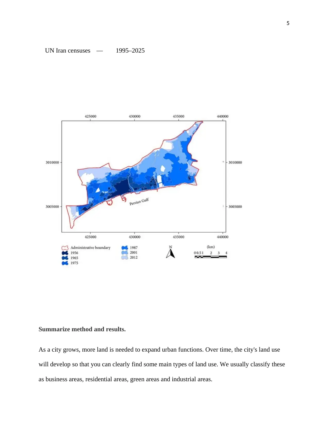
This report examines the urban growth of Bandar Abbas City, Iran, between 1956 and 2015, utilizing remote sensing techniques to analyze land use changes. The study reveals a significant increase in the urban area from 402.6 to 5343.59 hectares, accompanied by a thirty-fold population increase. The report highlights the challenges posed by structural and natural limitations, with a substantial portion of the land being barren or occupied by infrastructure. It also discusses the influence of industries like steel, refinery, and aluminum, along with tourism, on the city's growth. The analysis incorporates city models to understand the urban structure, considering factors such as business areas, residential zones, green spaces, and industrial areas. The report concludes by emphasizing the need for sustainable and balanced development through effective urban management and control of irregular expansion, with consideration of land use and economic activities. Desklib offers a range of study tools and solved assignments to aid students in similar analyses.

1 out of 9

Your All-in-One AI-Powered Toolkit for Academic Success.
+13062052269
info@desklib.com
Available 24*7 on WhatsApp / Email
![[object Object]](/_next/static/media/star-bottom.7253800d.svg)
Copyright © 2020–2026 A2Z Services. All Rights Reserved. Developed and managed by ZUCOL.