Environmental Management Reflective Essay: GIS Applications
VerifiedAdded on 2022/08/10
|12
|2075
|36
Essay
AI Summary
This essay explores the application of Geographic Information Systems (GIS) as a crucial tool for environmental management and promoting a sustainable future. It discusses the role of GIS in various aspects, including site management, air quality monitoring, and flood mapping, highlighting its capabilities in analyzing spatial data, identifying hazards, and supporting decision-making. The integration of Building Information Modeling (BIM) with GIS is also examined, emphasizing how this combination enhances efficiency in sustainable management and smart technology applications. The essay further delves into specific methodologies, such as the use of ArcGIS Online, and the evolution of GIS 3D technology. It underscores the importance of data integration, file formats, and the need for future-proof approaches to address integration issues, ultimately aiming for a more sustainable and habitable environment. The essay references various sources and reflects on the practical applications of GIS in environmental scenarios, as learned through course tutorials and lectures.

GIS and Environmental Management
Paraphrase This Document
Need a fresh take? Get an instant paraphrase of this document with our AI Paraphraser
Introduction:-
GIS is a tool that is used to promote and manage the environmental sustainability for
waste management. For natural disaster, DWMS (Disaster Waste Management Sites) plays an
essential role in the land analysis problem. This review is related to promote the use of GIS to
maintain a more sustainable future. In this study, ‘ArcGIS’ is used for land analysis and Model
builder functions are used to build the analysis model(Cheng and Thompson, 2016).In this
workflow BIM and GIS, integration increases the efficiency of sustainable management. BIM
(Building Information Modeling) is a process based on the 3D model that provides AEC
(Architecture, Engineering and Construction) professionals information and is a tool of efficient
design, plan, structures, manage buildings and construction. AEC industry now focuses more on
the BIM that is information-rich approach. It provides a robust model that captures the project
detail that may include graphics. This model also provides the simulation that shows after
construction how asset behaves in the real world
Discussion:-
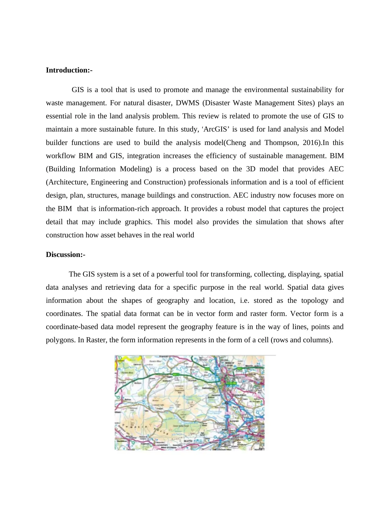
The GIS system is a set of a powerful tool for transforming, collecting, displaying, spatial
data analyses and retrieving data for a specific purpose in the real world. Spatial data gives
information about the shapes of geography and location, i.e. stored as the topology and
coordinates. The spatial data format can be in vector form and raster form. Vector form is a
coordinate-based data model represent the geography feature is in the way of lines, points and
polygons. In Raster, the form information represents in the form of a cell (rows and columns).
GIS is a tool that is used to promote and manage the environmental sustainability for
waste management. For natural disaster, DWMS (Disaster Waste Management Sites) plays an
essential role in the land analysis problem. This review is related to promote the use of GIS to
maintain a more sustainable future. In this study, ‘ArcGIS’ is used for land analysis and Model
builder functions are used to build the analysis model(Cheng and Thompson, 2016).In this
workflow BIM and GIS, integration increases the efficiency of sustainable management. BIM
(Building Information Modeling) is a process based on the 3D model that provides AEC
(Architecture, Engineering and Construction) professionals information and is a tool of efficient
design, plan, structures, manage buildings and construction. AEC industry now focuses more on
the BIM that is information-rich approach. It provides a robust model that captures the project
detail that may include graphics. This model also provides the simulation that shows after
construction how asset behaves in the real world
Discussion:-
The GIS system is a set of a powerful tool for transforming, collecting, displaying, spatial
data analyses and retrieving data for a specific purpose in the real world. Spatial data gives
information about the shapes of geography and location, i.e. stored as the topology and
coordinates. The spatial data format can be in vector form and raster form. Vector form is a
coordinate-based data model represent the geography feature is in the way of lines, points and
polygons. In Raster, the form information represents in the form of a cell (rows and columns).
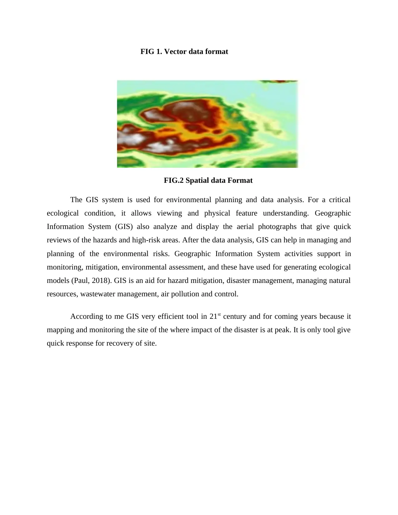
FIG 1. Vector data format
FIG.2 Spatial data Format
The GIS system is used for environmental planning and data analysis. For a critical
ecological condition, it allows viewing and physical feature understanding. Geographic
Information System (GIS) also analyze and display the aerial photographs that give quick
reviews of the hazards and high-risk areas. After the data analysis, GIS can help in managing and
planning of the environmental risks. Geographic Information System activities support in
monitoring, mitigation, environmental assessment, and these have used for generating ecological
models (Paul, 2018). GIS is an aid for hazard mitigation, disaster management, managing natural
resources, wastewater management, air pollution and control.
According to me GIS very efficient tool in 21st century and for coming years because it
mapping and monitoring the site of the where impact of the disaster is at peak. It is only tool give
quick response for recovery of site.
⊘ This is a preview!⊘
Do you want full access?
Subscribe today to unlock all pages.
Trusted by 1+ million students worldwide
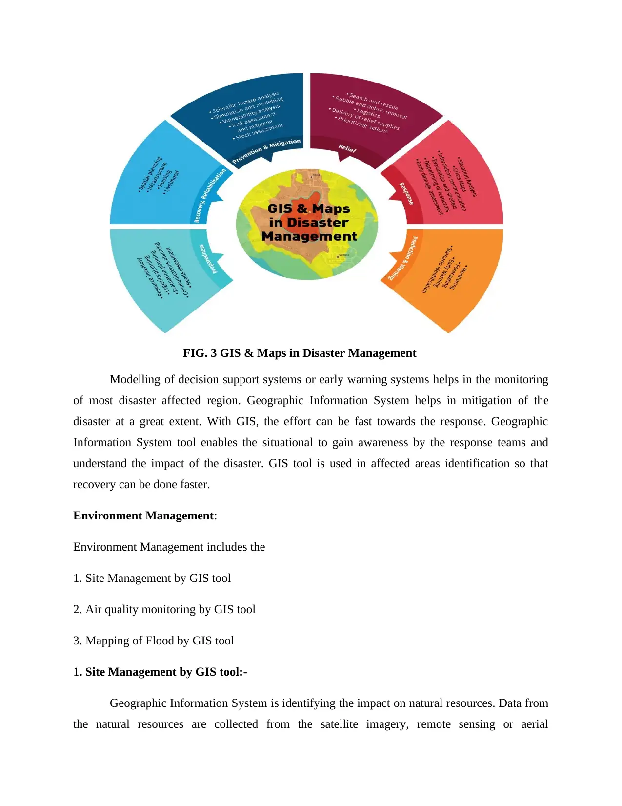
FIG. 3 GIS & Maps in Disaster Management
Modelling of decision support systems or early warning systems helps in the monitoring
of most disaster affected region. Geographic Information System helps in mitigation of the
disaster at a great extent. With GIS, the effort can be fast towards the response. Geographic
Information System tool enables the situational to gain awareness by the response teams and
understand the impact of the disaster. GIS tool is used in affected areas identification so that
recovery can be done faster.
Environment Management:
Environment Management includes the
1. Site Management by GIS tool
2. Air quality monitoring by GIS tool
3. Mapping of Flood by GIS tool
1. Site Management by GIS tool:-
Geographic Information System is identifying the impact on natural resources. Data from
the natural resources are collected from the satellite imagery, remote sensing or aerial
Paraphrase This Document
Need a fresh take? Get an instant paraphrase of this document with our AI Paraphraser
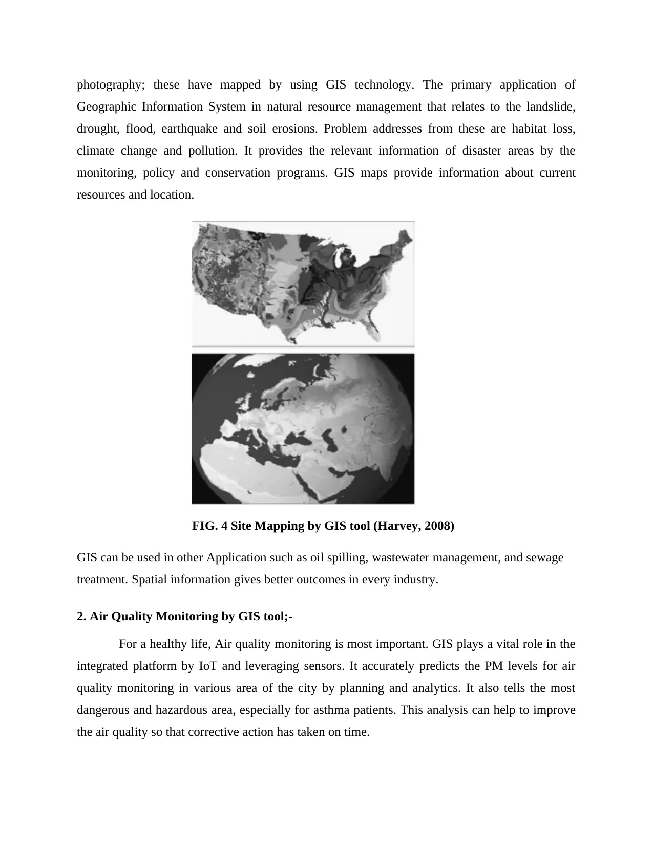
photography; these have mapped by using GIS technology. The primary application of
Geographic Information System in natural resource management that relates to the landslide,
drought, flood, earthquake and soil erosions. Problem addresses from these are habitat loss,
climate change and pollution. It provides the relevant information of disaster areas by the
monitoring, policy and conservation programs. GIS maps provide information about current
resources and location.
FIG. 4 Site Mapping by GIS tool (Harvey, 2008)
GIS can be used in other Application such as oil spilling, wastewater management, and sewage
treatment. Spatial information gives better outcomes in every industry.
2. Air Quality Monitoring by GIS tool;-
For a healthy life, Air quality monitoring is most important. GIS plays a vital role in the
integrated platform by IoT and leveraging sensors. It accurately predicts the PM levels for air
quality monitoring in various area of the city by planning and analytics. It also tells the most
dangerous and hazardous area, especially for asthma patients. This analysis can help to improve
the air quality so that corrective action has taken on time.
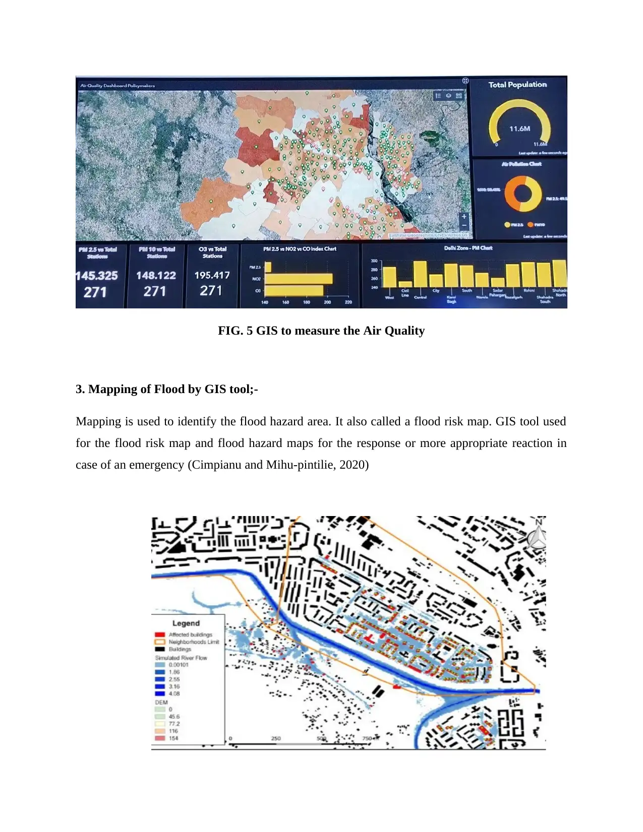
FIG. 5 GIS to measure the Air Quality
3. Mapping of Flood by GIS tool;-
Mapping is used to identify the flood hazard area. It also called a flood risk map. GIS tool used
for the flood risk map and flood hazard maps for the response or more appropriate reaction in
case of an emergency (Cimpianu and Mihu-pintilie, 2020)
3. Mapping of Flood by GIS tool;-
Mapping is used to identify the flood hazard area. It also called a flood risk map. GIS tool used
for the flood risk map and flood hazard maps for the response or more appropriate reaction in
case of an emergency (Cimpianu and Mihu-pintilie, 2020)
⊘ This is a preview!⊘
Do you want full access?
Subscribe today to unlock all pages.
Trusted by 1+ million students worldwide
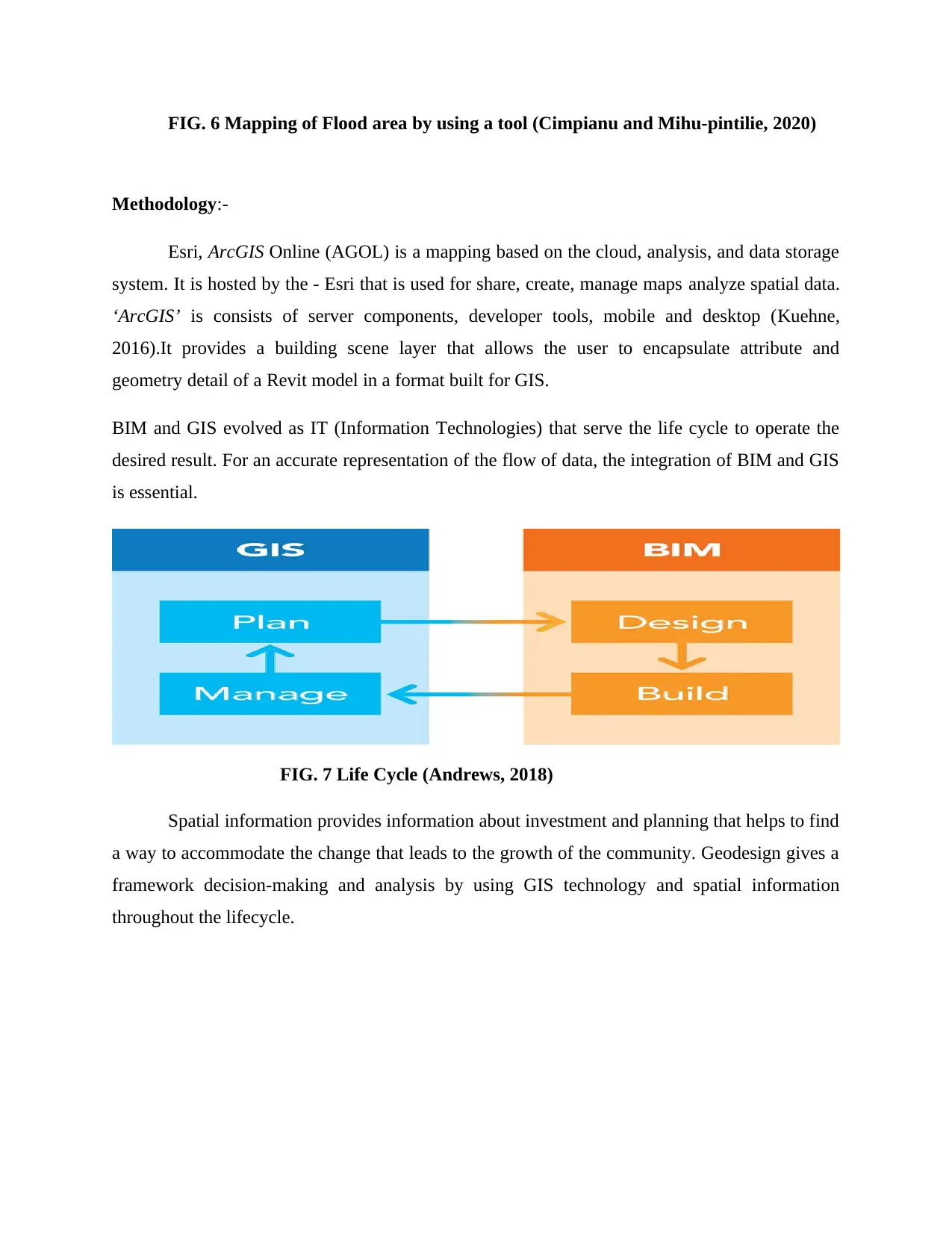
FIG. 6 Mapping of Flood area by using a tool (Cimpianu and Mihu-pintilie, 2020)
Methodology:-
Esri, ArcGIS Online (AGOL) is a mapping based on the cloud, analysis, and data storage
system. It is hosted by the - Esri that is used for share, create, manage maps analyze spatial data.
‘ArcGIS’ is consists of server components, developer tools, mobile and desktop (Kuehne,
2016).It provides a building scene layer that allows the user to encapsulate attribute and
geometry detail of a Revit model in a format built for GIS.
BIM and GIS evolved as IT (Information Technologies) that serve the life cycle to operate the
desired result. For an accurate representation of the flow of data, the integration of BIM and GIS
is essential.
FIG. 7 Life Cycle (Andrews, 2018)
Spatial information provides information about investment and planning that helps to find
a way to accommodate the change that leads to the growth of the community. Geodesign gives a
framework decision-making and analysis by using GIS technology and spatial information
throughout the lifecycle.
Paraphrase This Document
Need a fresh take? Get an instant paraphrase of this document with our AI Paraphraser
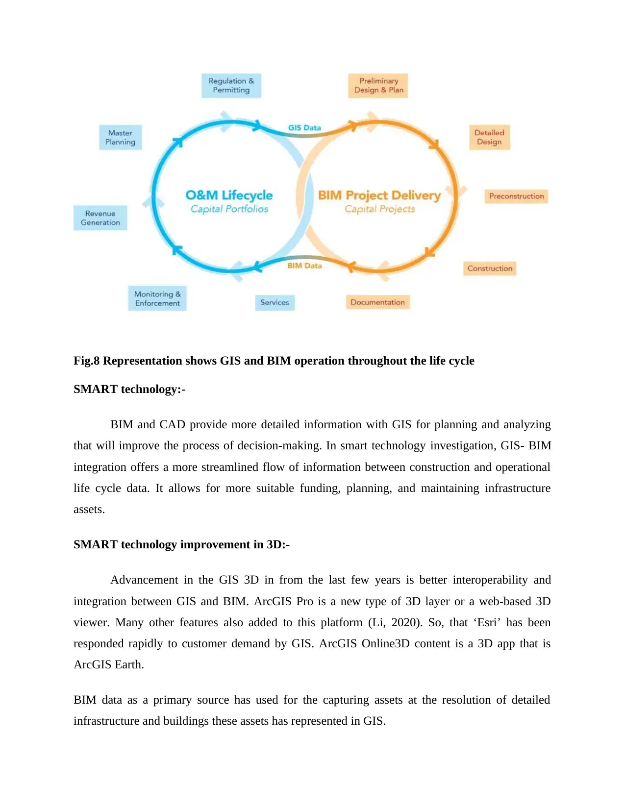
Fig.8 Representation shows GIS and BIM operation throughout the life cycle
SMART technology:-
BIM and CAD provide more detailed information with GIS for planning and analyzing
that will improve the process of decision-making. In smart technology investigation, GIS- BIM
integration offers a more streamlined flow of information between construction and operational
life cycle data. It allows for more suitable funding, planning, and maintaining infrastructure
assets.
SMART technology improvement in 3D:-
Advancement in the GIS 3D in from the last few years is better interoperability and
integration between GIS and BIM. ArcGIS Pro is a new type of 3D layer or a web-based 3D
viewer. Many other features also added to this platform (Li, 2020). So, that ‘Esri’ has been
responded rapidly to customer demand by GIS. ArcGIS Online3D content is a 3D app that is
ArcGIS Earth.
BIM data as a primary source has used for the capturing assets at the resolution of detailed
infrastructure and buildings these assets has represented in GIS.
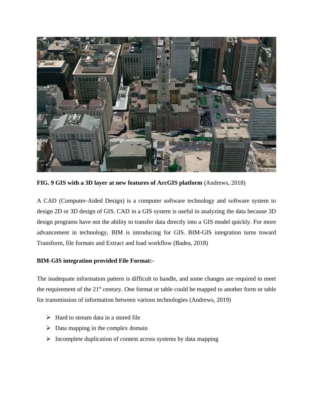
FIG. 9 GIS with a 3D layer at new features of ArcGIS platform (Andrews, 2018)
A CAD (Computer-Aided Design) is a computer software technology and software system to
design 2D or 3D design of GIS. CAD in a GIS system is useful in analyzing the data because 3D
design programs have not the ability to transfer data directly into a GIS model quickly. For more
advancement in technology, BIM is introducing for GIS. BIM-GIS integration turns toward
Transform, file formats and Extract and load workflow (Badea, 2018)
BIM-GIS integration provided File Format:-
The inadequate information pattern is difficult to handle, and some changes are required to meet
the requirement of the 21st century. One format or table could be mapped to another form or table
for transmission of information between various technologies (Andrews, 2019)
Hard to stream data in a stored file
Data mapping in the complex domain
Incomplete duplication of content across systems by data mapping
⊘ This is a preview!⊘
Do you want full access?
Subscribe today to unlock all pages.
Trusted by 1+ million students worldwide
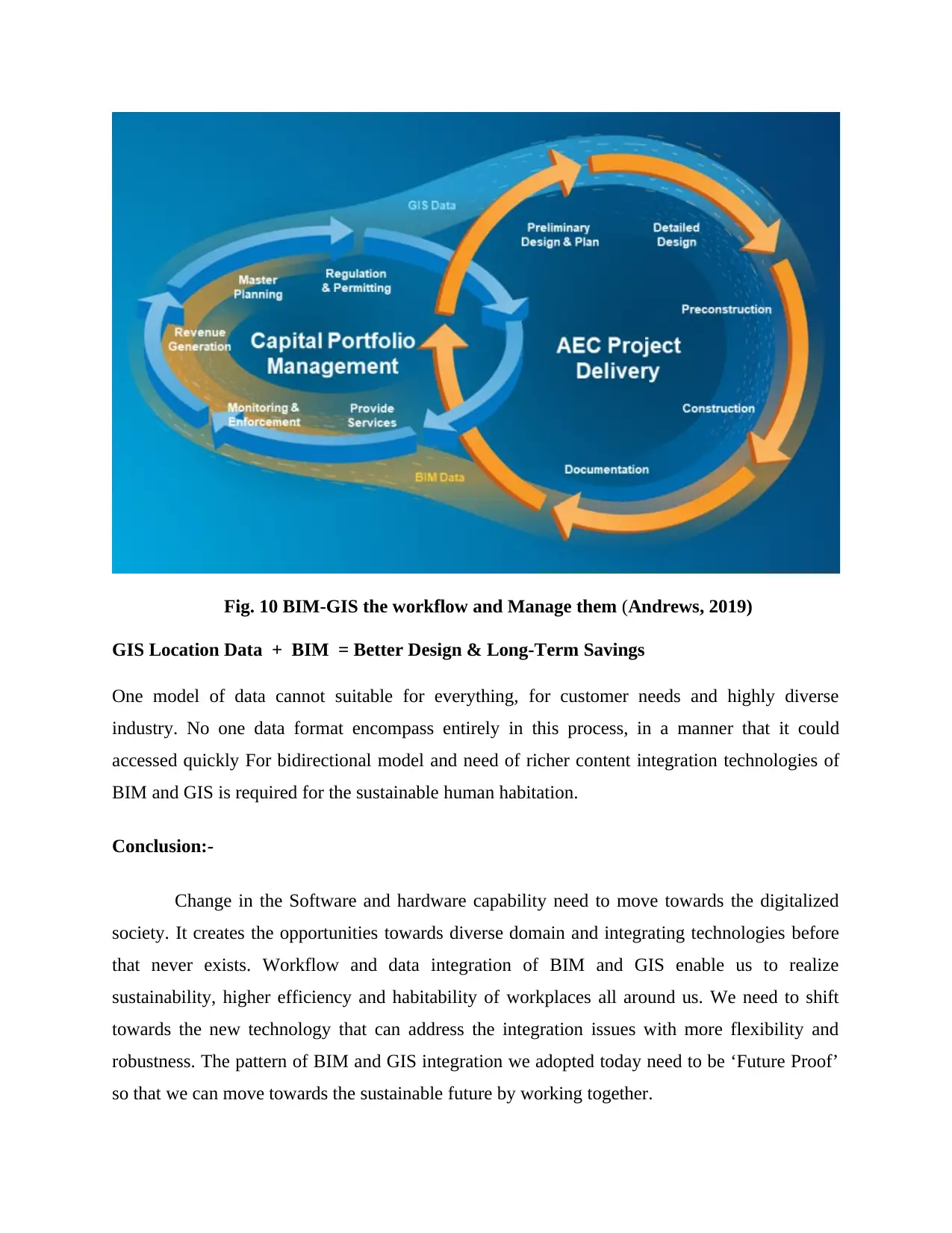
Fig. 10 BIM-GIS the workflow and Manage them (Andrews, 2019)
GIS Location Data + BIM = Better Design & Long-Term Savings
One model of data cannot suitable for everything, for customer needs and highly diverse
industry. No one data format encompass entirely in this process, in a manner that it could
accessed quickly For bidirectional model and need of richer content integration technologies of
BIM and GIS is required for the sustainable human habitation.
Conclusion:-
Change in the Software and hardware capability need to move towards the digitalized
society. It creates the opportunities towards diverse domain and integrating technologies before
that never exists. Workflow and data integration of BIM and GIS enable us to realize
sustainability, higher efficiency and habitability of workplaces all around us. We need to shift
towards the new technology that can address the integration issues with more flexibility and
robustness. The pattern of BIM and GIS integration we adopted today need to be ‘Future Proof’
so that we can move towards the sustainable future by working together.
Paraphrase This Document
Need a fresh take? Get an instant paraphrase of this document with our AI Paraphraser
References:-
Andrews, C. (14 february 2019) 5 myths and 5 realities of bim-gis integration. 3d visualization &
analytics. Available at https://www.esri.com/arcgis-blog/products/arcgis-pro/3d-gis/5-myths-5-
realities-bim-gis-integration/ [Accessed 14 february 2019].
Andrews, C. (2018). GIS and BIM Integration Leads to Smart Communities. Available from:
https://www.esri.com/about/newsroom/arcuser/gis-and-bim-integration-leads-to-smart-
communities/ [Accessed 2018 ].
Badea, A. and Badea, G. (2018) Section Cartography and GISBIM, GIS AND CAD(ASTRE)
UNDER THE CURRENT CHALLENGES. International Multidisciplinary Scientific
GeoConference. 18(2.3), pp. 329-336. Available from:
https://search.proquest.com/openview/9dd306ef12ace56d98ba58162fe8b5a5/1?pq-
origsite=gscholar&cbl=1536338 [Accessed 2018].
Cheng, C. and Thompson, R. (2016) Application of boolean logic and GIS for determining
suitable locations for Temporary Disaster Waste Management Sites. International Journal of
Disaster Risk Reduction. 20(https://doi.org/10.1016/j.ijdrr.2016.10.011), pp. 78-92. Available
from: https://www.sciencedirect.com/science/article/pii/S2212420916301881 [Accessed
December 2016].
Cimpianu, C. and Mihu-pintilie, A. (2020) OPEN SOURCE FLOOD MAPPING TOOLS –
QGIS, RIVER GIS AND HEC-RAS. ACTA GEOBALCANICA.
6(https://doi.org/10.18509/AGB.2020.04), pp. 35-41. Available from:
https://www.researchgate.net/profile/Catalin_Cimpianu/publication/
335534773_OPEN_SOURCE_FLOOD_MAPPING_TOOLS_-
_QGIS_RIVER_GIS_AND_HEC-RAS/links/5d76356d92851cacdb2c298f/OPEN-SOURCE-
FLOOD-MAPPING-TOOLS-QGIS-RIVER-GIS-AND-HEC-RAS.pdf [Accessed 01.09.2019].
Harvey, F. (2008) FUNDAMENTAL GEOGRAPHICAND CARTOGRAPHIC CONCEPTS. . ed.
New York: Guilford, pp. 321. [Accessed 2008].
Kuehne, D. (22 september 2016) Bim-gis integration with ifc. 3d visualization & analytics.
Available at https://www.esri.com/arcgis-blog/products/product/3d-gis/bim-gis-integration-with-
ifc/ [Accessed 22 september 2016].
Li, Z. (2020) Pipeline Spatial Data Modeling and Pipeline WebGIS. Component GIS, ArcObjects
and ArcGIS Server. .(https://doi.org/10.1007/978-3-030-24240-4_4), pp. 103-117. Available
from: https://link.springer.com/chapter/10.1007/978-3-030-24240-4_4 [Accessed 02 january
2020].
Paul, S. (07/04/2018) Managing the environment using gis. Geospatial World. Available at
https://www.geospatialworld.net/blogs/managing-the-environment-using-gis/ [Accessed
07/04/2018].

Souza melaré, A. and González, S. (2017) Technologies and decision support systems to aid
solid-waste management: a systematic review. Waste Management.
59(https://doi.org/10.1016/j.wasman.2016.10.045), pp. 567-584. Available from:
https://www.sciencedirect.com/science/article/pii/S0956053X16306171 [Accessed January
2017].
solid-waste management: a systematic review. Waste Management.
59(https://doi.org/10.1016/j.wasman.2016.10.045), pp. 567-584. Available from:
https://www.sciencedirect.com/science/article/pii/S0956053X16306171 [Accessed January
2017].
⊘ This is a preview!⊘
Do you want full access?
Subscribe today to unlock all pages.
Trusted by 1+ million students worldwide
1 out of 12


Your All-in-One AI-Powered Toolkit for Academic Success.
+13062052269
info@desklib.com
Available 24*7 on WhatsApp / Email
![[object Object]](/_next/static/media/star-bottom.7253800d.svg)
Unlock your academic potential
Copyright © 2020–2026 A2Z Services. All Rights Reserved. Developed and managed by ZUCOL.