Locating Burial Site Using Ground Penetrating Radar Report
VerifiedAdded on 2023/04/25
|5
|1165
|104
Report
AI Summary
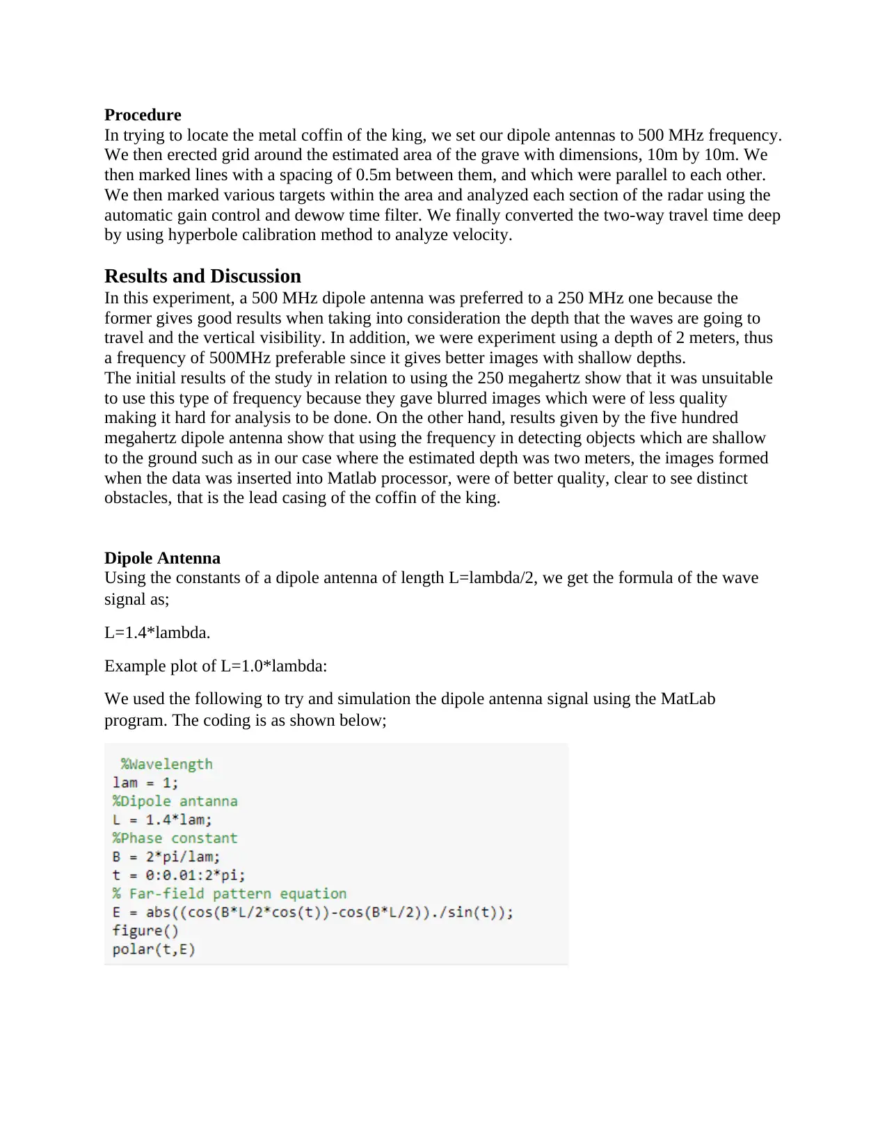
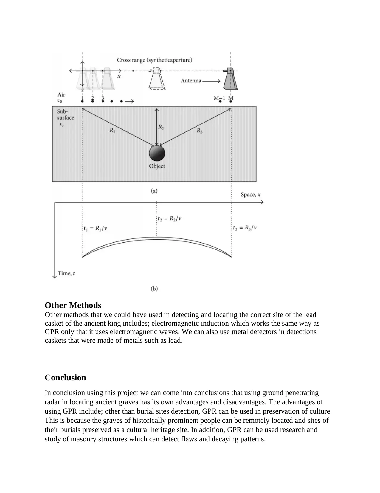
This report presents a study on using Ground Penetrating Radar (GPR) to locate an ancient burial site, specifically focusing on finding a lead coffin. The report outlines the methodology, including the use of a 500 MHz dipole antenna, grid setup, and data analysis using Matlab for creating 3D images (C-scan). The study compares the effectiveness of 250 MHz and 500 MHz frequencies, highlighting the superiority of the latter for clearer images at a depth of 2 meters. The report details the generation of high-frequency signals, the antenna design, and the A-Scan and B-Scan image analysis, concluding with a discussion of GPR's advantages, such as cultural preservation, and its limitations, including environmental factors like soil type and signal dispersion in rocky areas. The report also mentions alternative methods like electromagnetic induction and metal detectors, and it provides Matlab code used to simulate the dipole antenna signal. The report concludes that GPR is a useful tool for locating burial sites, but its effectiveness is dependent on environmental conditions.

1 out of 5
Your All-in-One AI-Powered Toolkit for Academic Success.
+13062052269
info@desklib.com
Available 24*7 on WhatsApp / Email
![[object Object]](/_next/static/media/star-bottom.7253800d.svg)
Copyright © 2020–2026 A2Z Services. All Rights Reserved. Developed and managed by ZUCOL.