Homework: Geography and Its Influence on Ancient Civilizations

Verified

Added on  2023/06/03

|2
|512
|289
Homework Assignment
AI Summary
This assignment explores the relationship between geography and the development of ancient civilizations. It covers topics such as major river systems like the Mississippi, Tigris, Euphrates, Rhine, and Nile, and their impact on civilization. It investigates the location of the Bantu homeland and the causes of climate change in Africa ten thousand years ago. Furthermore, it delves into the geography of Mesopotamia, including its climate, location relative to the equator, and surrounding geographical features like the Zagros Mountains and Arabian Desert. The assignment also touches upon historical events such as the extent of Sargon of Akkad's empire and territorial conflicts between the Egyptian and Hittite empires, concluding with the likely reason for Hammurabi's choice of Babylon as his capital. Desklib offers a wealth of similar assignments and study resources for students.
Document Page
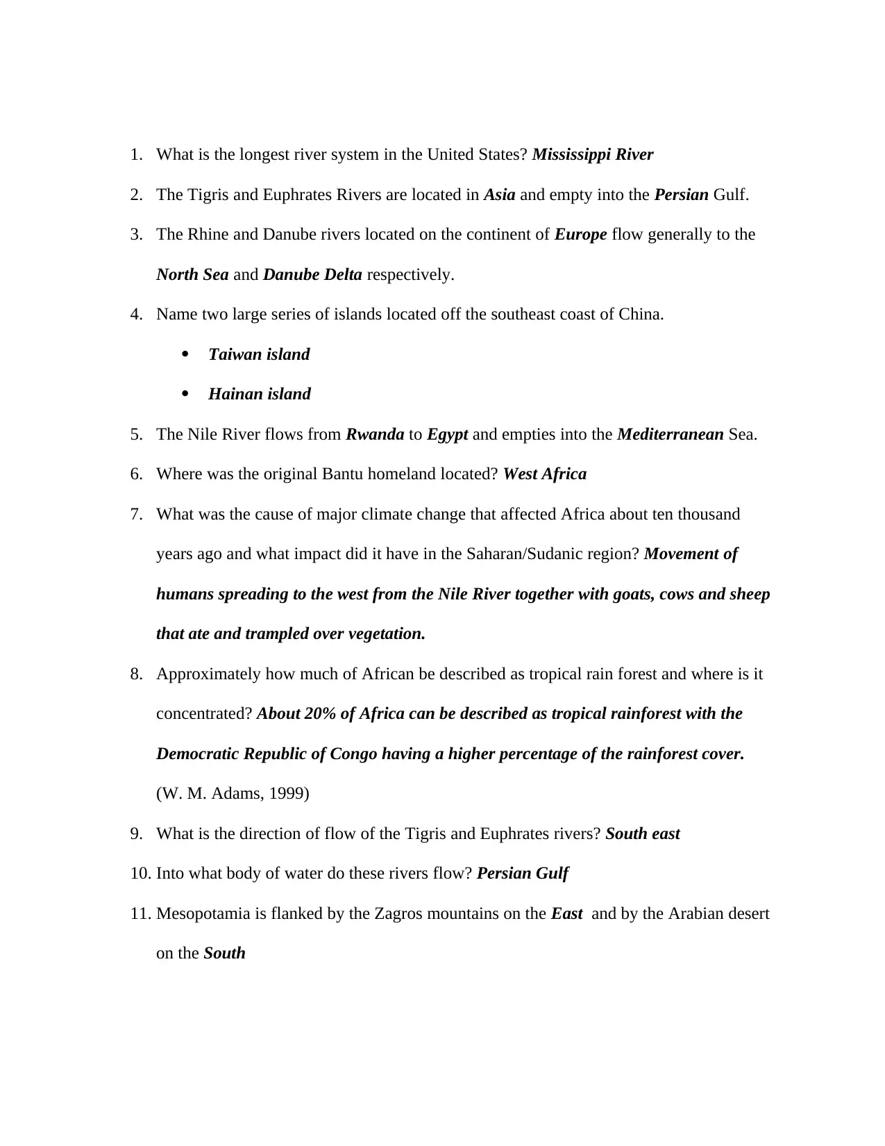
1. What is the longest river system in the United States? Mississippi River
2. The Tigris and Euphrates Rivers are located in Asia and empty into the Persian Gulf.
3. The Rhine and Danube rivers located on the continent of Europe flow generally to the
North Sea and Danube Delta respectively.
4. Name two large series of islands located off the southeast coast of China.
Taiwan island
Hainan island
5. The Nile River flows from Rwanda to Egypt and empties into the Mediterranean Sea.
6. Where was the original Bantu homeland located? West Africa
7. What was the cause of major climate change that affected Africa about ten thousand
years ago and what impact did it have in the Saharan/Sudanic region? Movement of
humans spreading to the west from the Nile River together with goats, cows and sheep
that ate and trampled over vegetation.
8. Approximately how much of African be described as tropical rain forest and where is it
concentrated? About 20% of Africa can be described as tropical rainforest with the
Democratic Republic of Congo having a higher percentage of the rainforest cover.
(W. M. Adams, 1999)
9. What is the direction of flow of the Tigris and Euphrates rivers? South east
10. Into what body of water do these rivers flow? Persian Gulf
11. Mesopotamia is flanked by the Zagros mountains on the East and by the Arabian desert
on the South
tabler-icon-diamond-filled.svg

Paraphrase This Document

Need a fresh take? Get an instant paraphrase of this document with our AI Paraphraser
Document Page
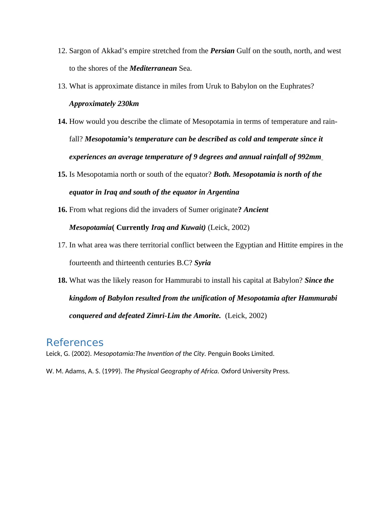
12. Sargon of Akkad’s empire stretched from the Persian Gulf on the south, north, and west
to the shores of the Mediterranean Sea.
13. What is approximate distance in miles from Uruk to Babylon on the Euphrates?
Approximately 230km
14. How would you describe the climate of Mesopotamia in terms of temperature and rain-
fall? Mesopotamia’s temperature can be described as cold and temperate since it
experiences an average temperature of 9 degrees and annual rainfall of 992mm
15. Is Mesopotamia north or south of the equator? Both. Mesopotamia is north of the
equator in Iraq and south of the equator in Argentina
16. From what regions did the invaders of Sumer originate? Ancient
Mesopotamia( Currently Iraq and Kuwait) (Leick, 2002)
17. In what area was there territorial conflict between the Egyptian and Hittite empires in the
fourteenth and thirteenth centuries B.C? Syria
18. What was the likely reason for Hammurabi to install his capital at Babylon? Since the
kingdom of Babylon resulted from the unification of Mesopotamia after Hammurabi
conquered and defeated Zimri-Lim the Amorite. (Leick, 2002)
References
Leick, G. (2002). Mesopotamia:The Invention of the City. Penguin Books Limited.
W. M. Adams, A. S. (1999). The Physical Geography of Africa. Oxford University Press.
chevron_up_icon
1 out of 2
circle_padding
hide_on_mobile
zoom_out_icon
[object Object]