Risk Identification and Mitigation Report: Santa Rosa Wildfire Hazards

Verified

Added on  2022/08/26

|5
|784
|20
Report
AI Summary
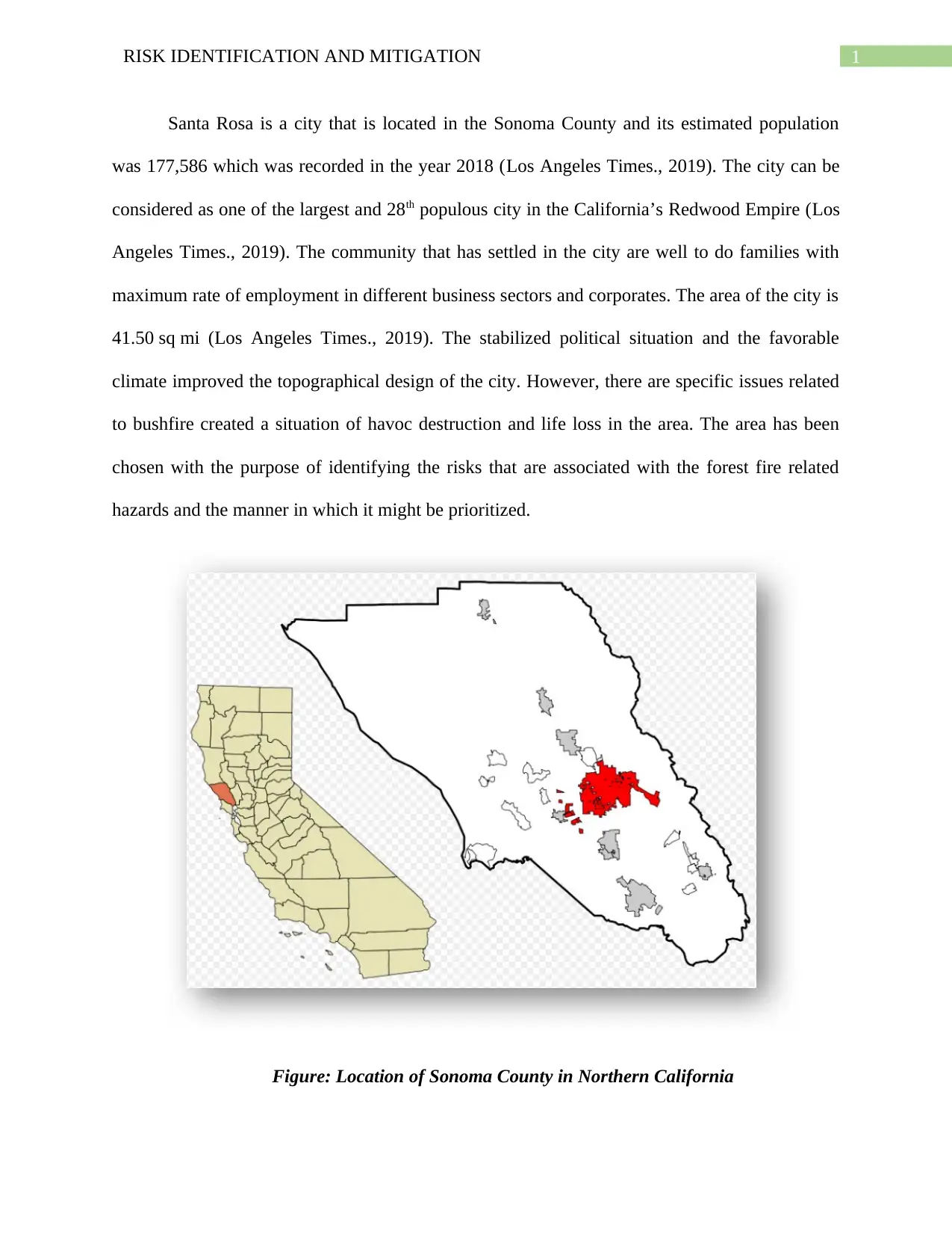
This report focuses on risk identification and mitigation related to wildfires in Santa Rosa, California. It begins by providing background information on Santa Rosa and Sonoma County, highlighting the area's demographics and geographical features. The report identifies the immediate threat of wildfires, referencing the Kincade and Tubbs fires, and emphasizes the loss of property and vegetation as major risks. It presents a risk assessment based on potential wildfire hazards and the community's existing hazard mitigation plan. The author proposes low-cost housing as a key strategy to minimize economic losses from wildfires and discusses the likelihood of risk occurrence and the effectiveness of infrastructure in controlling it. References from relevant academic sources are also provided, supporting the analysis and recommendations.
Document Page
Running head: RISK IDENTIFICATION AND MITIGATION
RISK IDENTIFICATION AND MITIGATION
Name of the student
Name of the university
Author note
tabler-icon-diamond-filled.svg

Paraphrase This Document

Need a fresh take? Get an instant paraphrase of this document with our AI Paraphraser
Document Page
1RISK IDENTIFICATION AND MITIGATION
Santa Rosa is a city that is located in the Sonoma County and its estimated population
was 177,586 which was recorded in the year 2018 (Los Angeles Times., 2019). The city can be
considered as one of the largest and 28th populous city in the California’s Redwood Empire (Los
Angeles Times., 2019). The community that has settled in the city are well to do families with
maximum rate of employment in different business sectors and corporates. The area of the city is
41.50 sq mi (Los Angeles Times., 2019). The stabilized political situation and the favorable
climate improved the topographical design of the city. However, there are specific issues related
to bushfire created a situation of havoc destruction and life loss in the area. The area has been
chosen with the purpose of identifying the risks that are associated with the forest fire related
hazards and the manner in which it might be prioritized.
Figure: Location of Sonoma County in Northern California
Document Page
2RISK IDENTIFICATION AND MITIGATION
(Source: Los Angeles Times., 2019)
The immediate threat that is being faced by the communities in Santa Rosa is related to
the widespread of wildfire. It has been noted through an article that was published in 2017 that
an evacuation order was given from the government and the local hazard management teams in
respect to the Kincade fire (Fuchs & Thaler, 2017). The increased threat of the wildfires are
estimated by the fire officials with the return of the diablo winds to Northern California (Fuchs
& Thaler, 2017). The major risks are specifically based on the loss of property and vegetation in
the region due to the intensified impact of the wildfire.
I compiled the list of risks based on the assessment of the tentative threats that might be
imposed by the forest fire. The community already holds a local hazard mitigation plan with the
objective of improving the rate of operations of the venture while operating in the different
markets. Birkmann (2016) stated that the different changes in the hazard based operations are
related to the assessment of the risk factors. In this connection, the community has already
employed a group of hazard management experts and a mitigation plan for meeting the risks.
I believe that a low cost yet durable housing facility might be created with the objective
of mi9nimizing the loss of property and materials in time of a crisis situation. The development
of low cost housing facilities would help the communities in minimizing the economic losses
that might be incurred by the same through the wild fires. The lower likelihood of the risk is
subjected to the likelihood of its occurrence. The last forest fire incident occurred in the year
2017 and since then the risk subsided with the further development of the hazard management
practices. In this relation, the proposition of low cost infrastructures would minimize the risk of
loss of property and economy. Therefore, the infrastructure would help in influencing the risk
Document Page
3RISK IDENTIFICATION AND MITIGATION
occurrence and the manner in which the same might be controlled through the low cost
infrastructural facilities.
References
Birkmann, J. (2016). Urban and Spatial Planning in Natural Hazard Risk Management.
In Oxford Research Encyclopedia of Natural Hazard Science.
Fuchs, S., & Thaler, T. (2017). Tipping Points in Natural Hazard Risk Management: How
Societal Transformation can Provoke Policy Strategies in Mitigation. Journal of Extreme
Events, 4(01), 1750006.
Los Angeles Times. (2019). The same areas of California keep catching on fire. What about
limits on home building?. Retrieved 13 January 2020, from
https://www.latimes.com/california/story/2019-10-28/kincade-getty-fire-prone-
neighborhood-limit-homebuilding
tabler-icon-diamond-filled.svg

Paraphrase This Document

Need a fresh take? Get an instant paraphrase of this document with our AI Paraphraser
Document Page
4RISK IDENTIFICATION AND MITIGATION
References: APA
Count: 2
On Sunday, residents of Coffey Park, a neighborhood in Santa Rosa that was leveled in the
Tubbs fire in 2017, received evacuation orders over the Kincade fire, which is currently ripping
through Sonoma County. The community has yet to see damage from the new blaze, but some
areas burned by the Kincade fire overlap with those affected two years ago — and fire officials
fear the flames could grow when Diablo winds return to Northern California later this week.
chevron_up_icon
1 out of 5
circle_padding
hide_on_mobile
zoom_out_icon
[object Object]