logo

Geographical Information System

Answering questions about the basic elements of a change control process and reviewing an example of a project management problem.

31 Pages4055 Words447 Views
   

Added on  2022-12-02

About This Document

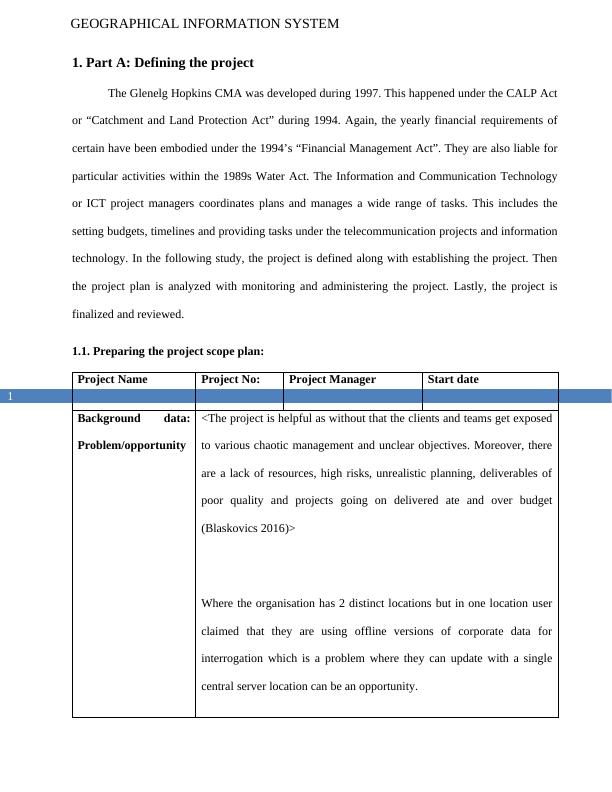
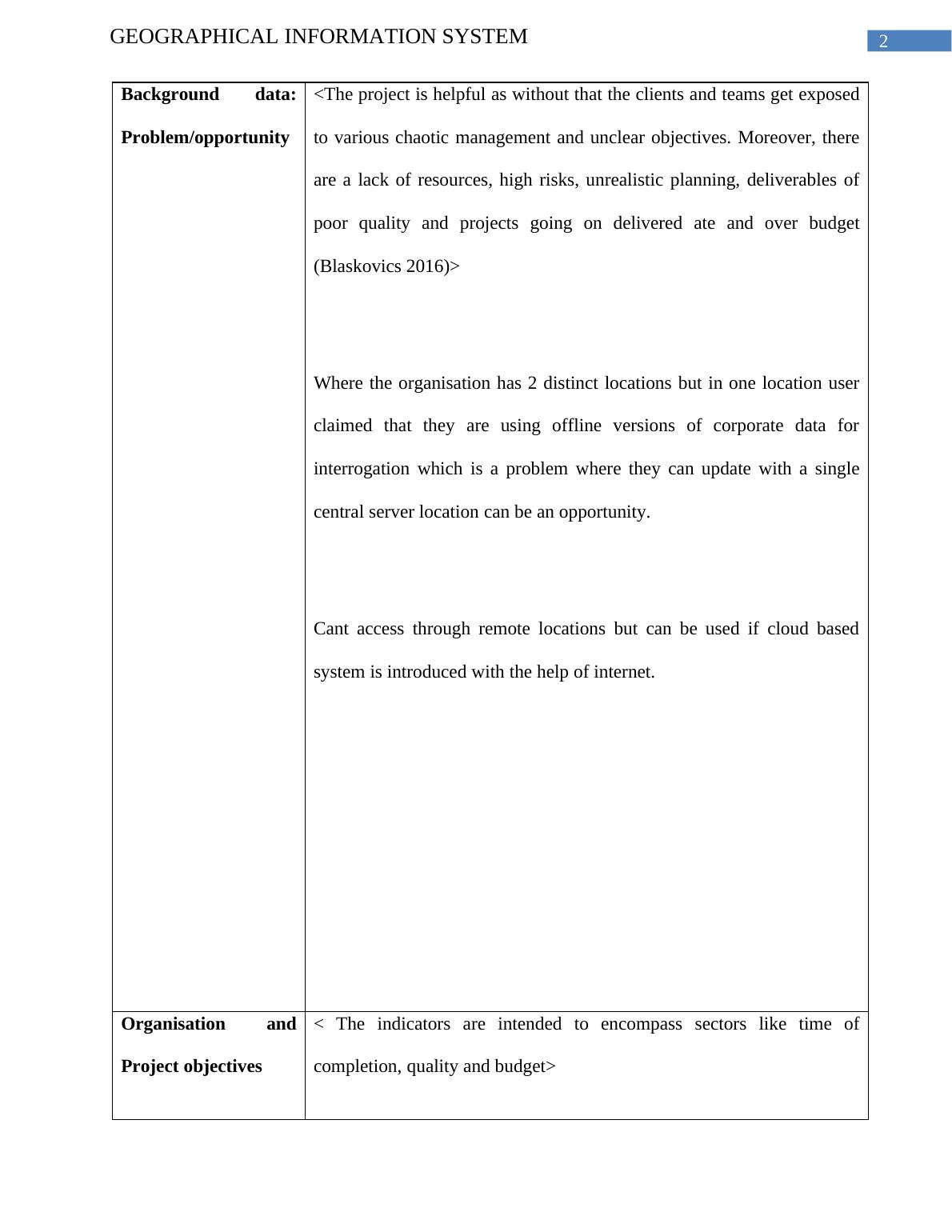
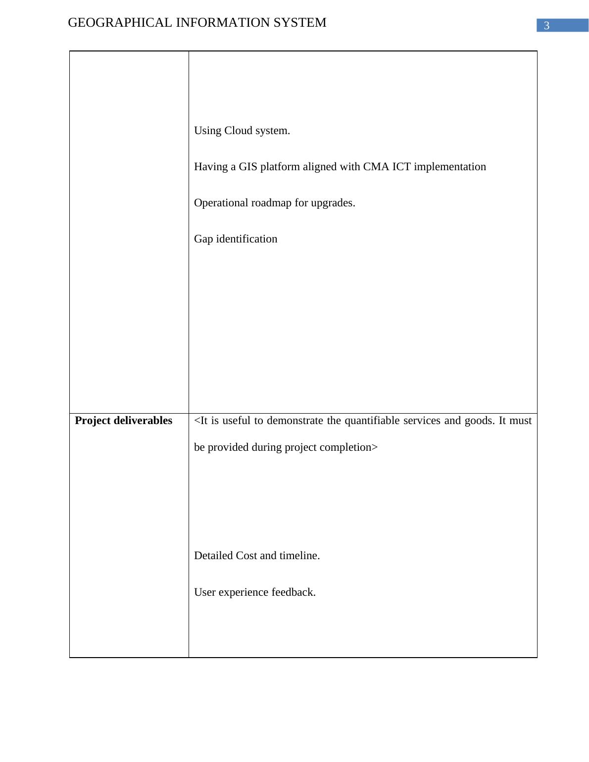
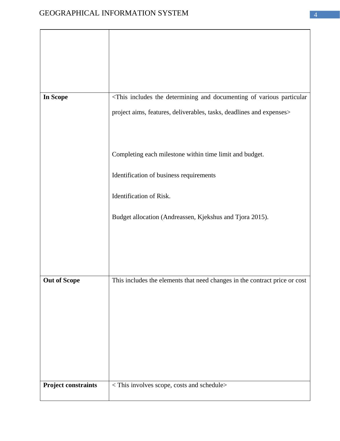
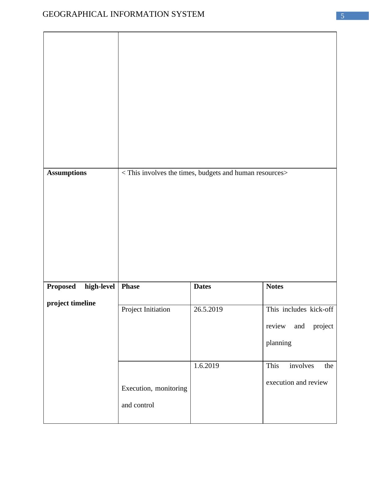
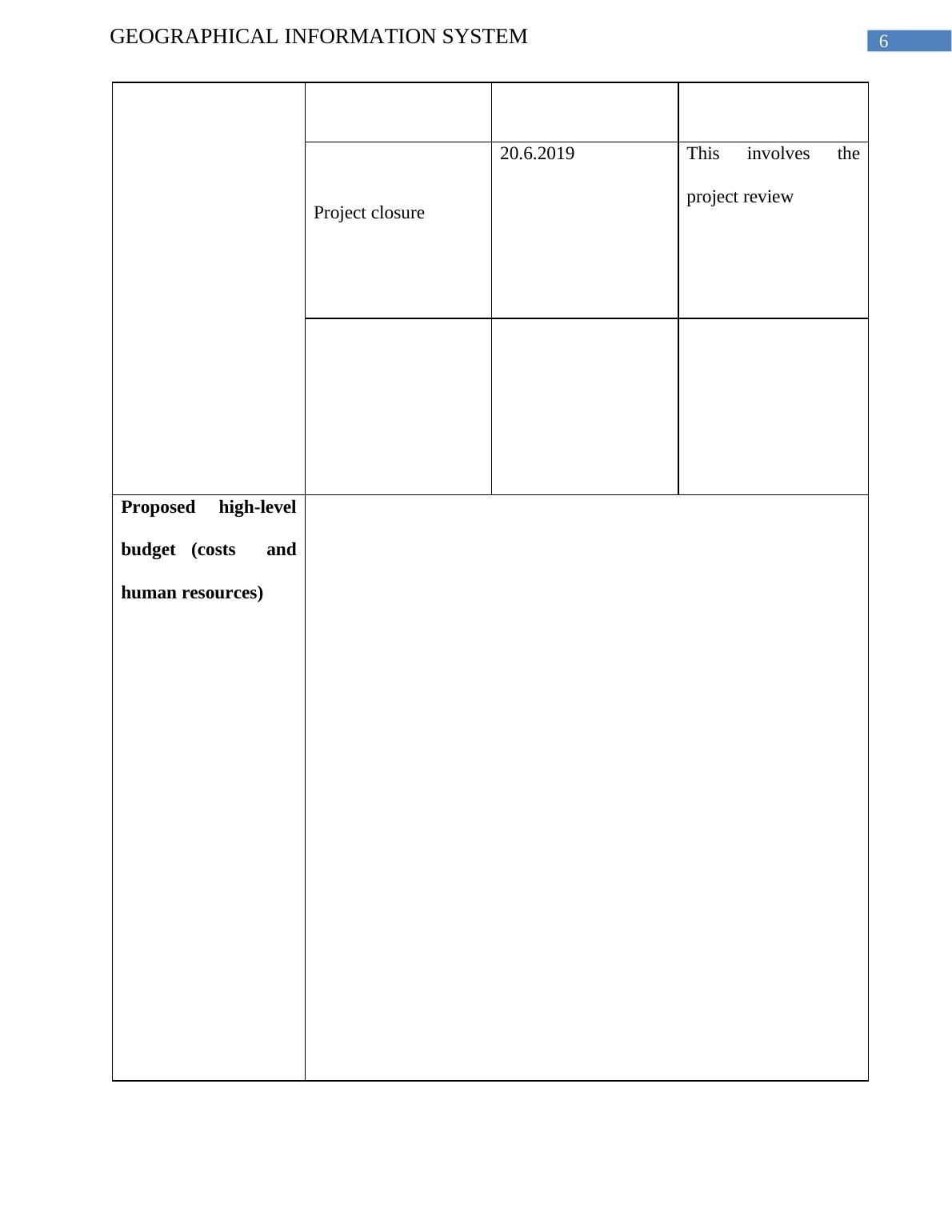
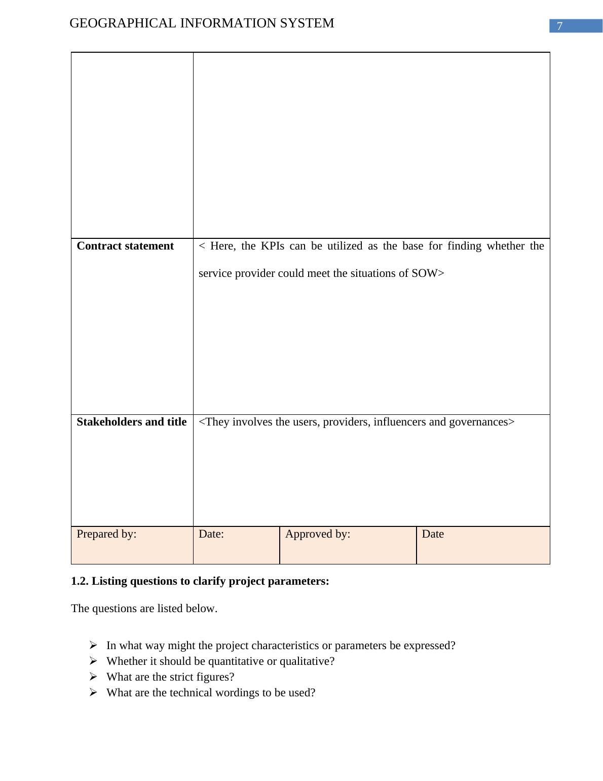
This document provides a comprehensive study on Geographical Information System (GIS). It covers topics such as project definition, project scope plan, project structure chart, project timeline, project budget, project charter, project objectives, project risks, project plan, and project monitoring and administration.

Geographical Information System

Answering questions about the basic elements of a change control process and reviewing an example of a project management problem.

   Added on 2022-12-02

ShareRelated Documents
Running head: GEOGRAPHICAL INFORMATION SYSTEM
Geographical Information System
Name of the student:
Name of the university:
Author Note
Geographical Information System_1
GEOGRAPHICAL INFORMATION SYSTEM
1
1. Part A: Defining the project
The Glenelg Hopkins CMA was developed during 1997. This happened under the CALP Act
or “Catchment and Land Protection Act” during 1994. Again, the yearly financial requirements of
certain have been embodied under the 1994’s “Financial Management Act”. They are also liable for
particular activities within the 1989s Water Act. The Information and Communication Technology
or ICT project managers coordinates plans and manages a wide range of tasks. This includes the
setting budgets, timelines and providing tasks under the telecommunication projects and information
technology. In the following study, the project is defined along with establishing the project. Then
the project plan is analyzed with monitoring and administering the project. Lastly, the project is
finalized and reviewed.
1.1. Preparing the project scope plan:
Project Name Project No: Project Manager Start date
Background data:
Problem/opportunity
<The project is helpful as without that the clients and teams get exposed
to various chaotic management and unclear objectives. Moreover, there
are a lack of resources, high risks, unrealistic planning, deliverables of
poor quality and projects going on delivered ate and over budget
(Blaskovics 2016)>
Where the organisation has 2 distinct locations but in one location user
claimed that they are using offline versions of corporate data for
interrogation which is a problem where they can update with a single
central server location can be an opportunity.
Geographical Information System_2
GEOGRAPHICAL INFORMATION SYSTEM
2
Cant access through remote locations but can be used if cloud based
system is introduced with the help of internet.
Organisation and
Project objectives
< The indicators are intended to encompass sectors like time of
completion, quality and budget>
Using Cloud system.
Having a GIS platform aligned with CMA ICT implementation
Operational roadmap for upgrades.
Gap identification
Geographical Information System_3
GEOGRAPHICAL INFORMATION SYSTEM
3
Project deliverables <It is useful to demonstrate the quantifiable services and goods. It must
be provided during project completion>
Detailed Cost and timeline.
User experience feedback.
In Scope <This includes the determining and documenting of various particular
project aims, features, deliverables, tasks, deadlines and expenses>
Completing each milestone within time limit and budget.
Identification of business requirements
Identification of Risk.
Geographical Information System_4
GEOGRAPHICAL INFORMATION SYSTEM
4
Budget allocation (Andreassen, Kjekshus and Tjora 2015).
Out of Scope This includes the elements that need changes in the contract price or cost
Project constraints < This involves scope, costs and schedule>
Assumptions < This involves the times, budgets and human resources>
Geographical Information System_5
GEOGRAPHICAL INFORMATION SYSTEM
5
Proposed high-level
project timeline
Phase Dates Notes
Project Initiation 26.5.2019 This includes kick-off
review and project
planning
Execution, monitoring
and control
1.6.2019 This involves the
execution and review
Project closure
20.6.2019 This involves the
project review
Proposed high-level
budget (costs and
human resources)
Geographical Information System_6
GEOGRAPHICAL INFORMATION SYSTEM
6
Contract statement < Here, the KPIs can be utilized as the base for finding whether the
service provider could meet the situations of SOW>
Stakeholders and title <They involves the users, providers, influencers and governances>
Geographical Information System_7
GEOGRAPHICAL INFORMATION SYSTEM
7
Prepared by: Date: Approved by: Date
1.2. Listing questions to clarify project parameters:
The questions are listed below.
In what way might the project characteristics or parameters be expressed?
Whether it should be quantitative or qualitative?
What are the strict figures?
What are the technical wordings to be used?
What are graphics to be implemented in the project?
1.3. Project structure chart involving stakeholder and authority:
Figure 1: “Project structure chart
(Source: Lappi, Aaltonen and Kujala 2018)
Geographical Information System_8

End of preview

Want to access all the pages? Upload your documents or become a member.

Related Documents
Development of a Cloud Computing Customer Relationship System
|14
|2893
|48

VUIS CONSULTING Project Plan
|16
|3809
|22

Implementation of an Information System in Sunny Delight Beverages Co.
|25
|1545
|192

PGBM 48 Project Management
|9
|1541
|198

Project Charter Template Question Answer 2022
|5
|978
|21

VUIS Consulting Project Status Report
|8
|1566
|21